avia.wikisort.org - Aerodrome
Atoka Municipal Airport (ICAO: KAQR, FAA LID: AQR) is a mile north of Atoka, in Atoka County, Oklahoma.[1] The National Plan of Integrated Airport Systems for 2021-2025 categorized it as a general aviation airport.[2]
Atoka Municipal Airport | |||||||||||
|---|---|---|---|---|---|---|---|---|---|---|---|
| |||||||||||
| Summary | |||||||||||
| Airport type | Public | ||||||||||
| Owner | City of Atoka | ||||||||||
| Serves | Atoka, Oklahoma | ||||||||||
| Elevation AMSL | 590 ft / 180 m | ||||||||||
| Coordinates | 34°23′54″N 096°08′53″W | ||||||||||
| Map | |||||||||||
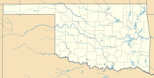 AQR | |||||||||||
| Runways | |||||||||||
| |||||||||||
| Statistics (2009) | |||||||||||
| |||||||||||
Source: Federal Aviation Administration[1] | |||||||||||
Most U.S. airports use the same three-letter location identifier for the FAA and IATA, but this airport is AQR to the FAA[1] and has no IATA code.[3][4]
Facilities
The airport covers 490 acres (198 ha) at an elevation of 590 feet (180 m). Its single runway, 18/36, is 3,015 by 40 feet (919 x 12 m) asphalt. In the year ending July 28, 2009 the airport had 3,500 general aviation aircraft operations, average 291 per month.[1]
References
- FAA Airport Form 5010 for AQR PDF. Federal Aviation Administration. Effective May 31, 2012.
- "National Plan of Integrated Airport Systems (2021-2025), page A-83" (PDF). FAA. Retrieved December 28, 2020.
- "Atoka Municipal Airport (FAA: AQR, ICAO: KAQR, IATA: none)". Great Circle Mapper. Retrieved December 15, 2012.
- "IATA Airport Code Search". International Air Transport Association. Retrieved December 15, 2012.
External links
- Atoka Municipal Airport (AQR) at Oklahoma Aeronautics Commission
- Aerial image as of March 1995 from USGS The National Map
- Resources for this airport:
- FAA airport information for AQR
- AirNav airport information for KAQR
- FlightAware airport information and live flight tracker
- NOAA/NWS weather observations: current, past three days
- SkyVector aeronautical chart, Terminal Procedures
Текст в блоке "Читать" взят с сайта "Википедия" и доступен по лицензии Creative Commons Attribution-ShareAlike; в отдельных случаях могут действовать дополнительные условия.
Другой контент может иметь иную лицензию. Перед использованием материалов сайта WikiSort.org внимательно изучите правила лицензирования конкретных элементов наполнения сайта.
Другой контент может иметь иную лицензию. Перед использованием материалов сайта WikiSort.org внимательно изучите правила лицензирования конкретных элементов наполнения сайта.
2019-2025
WikiSort.org - проект по пересортировке и дополнению контента Википедии
WikiSort.org - проект по пересортировке и дополнению контента Википедии