avia.wikisort.org - Aerodrome
Boyer Flight Park (FAA LID: 7W7) is a public use ultralight airport in Carroll County, Indiana, United States.[1] It is located four nautical miles (7 km) southwest of the central business district of Burnettsville,[1] a town in White County.
Boyer Flight Park | |||||||||||
|---|---|---|---|---|---|---|---|---|---|---|---|
| |||||||||||
| Summary | |||||||||||
| Airport type | Public use | ||||||||||
| Owner | Gayle High | ||||||||||
| Serves | Burnettsville, Indiana | ||||||||||
| Location | Carroll County, Indiana | ||||||||||
| Elevation AMSL | 710 ft / 216 m | ||||||||||
| Coordinates | 40°43′12″N 086°36′58″W | ||||||||||
| Map | |||||||||||
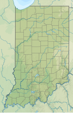 7W7 Location of airport in Indiana | |||||||||||
| Runways | |||||||||||
| |||||||||||
| Statistics (2010) | |||||||||||
| |||||||||||
Source: Federal Aviation Administration[1] | |||||||||||
Facilities and aircraft
Boyer Flight Park covers an area of 7 acres (3 ha) at an elevation of 710 feet (216 m) above mean sea level. It has one runway designated 18/36 with a turf surface measuring 1,770 by 120 feet (539 x 37 m).[1]
For the 12-month period ending December 31, 2010, the airport had 218 general aviation aircraft operations, an average of 18 per month. There are two ultralight aircraft based at this airport.[1]
See also
References
- FAA Airport Form 5010 for 7W7 PDF. Federal Aviation Administration. Effective August 25, 2011.
External links
- Aerial image from USGS The National Map
Текст в блоке "Читать" взят с сайта "Википедия" и доступен по лицензии Creative Commons Attribution-ShareAlike; в отдельных случаях могут действовать дополнительные условия.
Другой контент может иметь иную лицензию. Перед использованием материалов сайта WikiSort.org внимательно изучите правила лицензирования конкретных элементов наполнения сайта.
Другой контент может иметь иную лицензию. Перед использованием материалов сайта WikiSort.org внимательно изучите правила лицензирования конкретных элементов наполнения сайта.
2019-2025
WikiSort.org - проект по пересортировке и дополнению контента Википедии
WikiSort.org - проект по пересортировке и дополнению контента Википедии