avia.wikisort.org - Aerodrome
C. A. Moore Airport (FAA LID: 19M) is a public use airport located two nautical miles (4 km) northeast of the central business district of Lexington, a city in Holmes County, Mississippi, United States.[1] Owned by the City of Lexington,[1] it is included in the National Plan of Integrated Airport Systems for 2011–2015, which categorized it as a general aviation facility.[2]
C. A. Moore Airport | |||||||||||
|---|---|---|---|---|---|---|---|---|---|---|---|
| |||||||||||
| Summary | |||||||||||
| Airport type | Public | ||||||||||
| Owner | City of Lexington | ||||||||||
| Serves | Lexington, Mississippi | ||||||||||
| Elevation AMSL | 340 ft / 104 m | ||||||||||
| Coordinates | 33°07′32″N 090°01′32″W | ||||||||||
| Map | |||||||||||
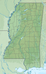 19M Location of airport in Mississippi | |||||||||||
| Runways | |||||||||||
| |||||||||||
| Statistics (2012) | |||||||||||
| |||||||||||
Source: Federal Aviation Administration[1] | |||||||||||
Facilities and aircraft
C. A. Moore Airport covers an area of 90 acres (36 ha) at an elevation of 340 feet (104 m) above mean sea level. It has one runway designated 1/19 with an asphalt surface measuring 3,199 by 60 feet (975 x 18 m).[1]
For the 12-month period ending February 23, 2012, the airport had 2,575 general aviation aircraft operations, an average of 214 per month. At that time there were four single-engine aircraft based at this airport.[1]
See also
References
- FAA Airport Form 5010 for 19M PDF. Federal Aviation Administration. Effective November 15, 2012.
- "2011–2015 NPIAS Report, Appendix A" (PDF). National Plan of Integrated Airport Systems. Federal Aviation Administration. October 4, 2010. Archived from the original (PDF, 2.03 MB) on 2012-09-27.
External links
- FAA Terminal Procedures for 19M, effective August 11, 2022
- Resources for this airport:
- FAA airport information for 19M
- AirNav airport information for 19M
- FlightAware airport information and live flight tracker
- SkyVector aeronautical chart for 19M
Другой контент может иметь иную лицензию. Перед использованием материалов сайта WikiSort.org внимательно изучите правила лицензирования конкретных элементов наполнения сайта.
WikiSort.org - проект по пересортировке и дополнению контента Википедии