avia.wikisort.org - Aerodrome
Coleman Municipal Airport (IATA: COM, ICAO: KCOM) is an airport two miles northeast of Coleman, Texas.
This article does not cite any sources. (May 2020) |
Coleman Municipal Airport | |||||||||||
|---|---|---|---|---|---|---|---|---|---|---|---|
 1994 USGS Photo | |||||||||||
| |||||||||||
| Summary | |||||||||||
| Airport type | Public | ||||||||||
| Owner | City of Coleman | ||||||||||
| Location | Coleman, Texas | ||||||||||
| Elevation AMSL | 1,697 ft / 517 m | ||||||||||
| Coordinates | 31°50′28″N 99°24′12″W | ||||||||||
| Runways | |||||||||||
| |||||||||||
History
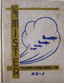
Opened on 1 October 1941. Began training United States Army Air Corps flying cadets under contract to Coleman Flying School under 304th Flying Training Detachment. Assigned to United States Army Air Forces Gulf Coast Training Center (later Central Flying Training Command) as a primary (level 1) pilot training airfield. had four local axillary airfields for emergency and overflow landings. Flying training was performed with Fairchild PT-19s as the primary trainer. Also had several PT-17 Stearmans assigned.
Inactivated on 16 October 1944, with the drawdown of AAFTC's pilot training program. Declared surplus and turned over to the Army Corps of Engineers on 30 September 1945. Eventually discharged to the War Assets Administration (WAA) and became a civil airport.
Airline flights (Trans-Texas DC-3s) ended in 1957.
See also
- Texas World War II Army Airfields
- 31st Flying Training Wing (World War II)
References
![]() This article incorporates public domain material from the Air Force Historical Research Agency website https://www.afhra.af.mil/.
This article incorporates public domain material from the Air Force Historical Research Agency website https://www.afhra.af.mil/.
- Manning, Thomas A. (2005), History of Air Education and Training Command, 1942–2002. Office of History and Research, Headquarters, AETC, Randolph AFB, Texas OCLC 71006954, 29991467
- Shaw, Frederick J. (2004), Locating Air Force Base Sites, History’s Legacy, Air Force History and Museums Program, United States Air Force, Washington DC. OCLC 57007862, 1050653629
External links
- FAA Terminal Procedures for COM, effective July 14, 2022
- Resources for this airport:
- FAA airport information for COM
- AirNav airport information for COM
- FlightAware airport information and live flight tracker
- SkyVector aeronautical chart for COM
| Flying Training |
|  | ||||
|---|---|---|---|---|---|---|
| Technical Training |
| |||||
Другой контент может иметь иную лицензию. Перед использованием материалов сайта WikiSort.org внимательно изучите правила лицензирования конкретных элементов наполнения сайта.
WikiSort.org - проект по пересортировке и дополнению контента Википедии