avia.wikisort.org - Aerodrome
Corry–Lawrence Airport (FAA LID: 8G2) is a public use airport located one nautical mile (2 km) south of the central business district of Corry, a city in Erie County, Pennsylvania, United States.[1] It is owned by the Airport Authority City of Corry,[1] also known as the Corry Lawrence Airport Authority.[2] This airport is included in the National Plan of Integrated Airport Systems for 2011–2015, which categorized it as a general aviation facility.[3]
Corry–Lawrence Airport | |||||||||||
|---|---|---|---|---|---|---|---|---|---|---|---|
| |||||||||||
| Summary | |||||||||||
| Airport type | Public | ||||||||||
| Owner | Airport Authority City of Corry | ||||||||||
| Serves | Corry, Pennsylvania | ||||||||||
| Elevation AMSL | 1,766 ft / 538 m | ||||||||||
| Coordinates | 41°54′27″N 079°38′28″W | ||||||||||
| Map | |||||||||||
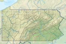 8G2 Location of airport in Pennsylvania | |||||||||||
| Runways | |||||||||||
| |||||||||||
| Statistics (2012) | |||||||||||
| |||||||||||
Source: Federal Aviation Administration[1] | |||||||||||
Facilities and aircraft
Corry–Lawrence Airport covers an area of 69 acres (28 ha) at an elevation of 1,766 feet (538 m) above mean sea level. It has one runway designated 14/32 with an asphalt surface measuring 4,101 by 75 feet (1,250 x 23 m).[1]
For the 12-month period ending July 30, 2012, the airport had 3,820 aircraft operations, an average of 10 per day: 99.5% general aviation and 0.5% military. At that time there were 12 aircraft based at this airport: 83% single-engine, 8% multi-engine, and 8% helicopter.[1]
See also
References
- FAA Airport Form 5010 for 8G2 PDF. Federal Aviation Administration. Effective November 15, 2012.
- "Government". Corry, Pennsylvania. Archived from the original on 2014-08-12. Retrieved 2014-08-10.
Corry Lawrence Airport – 800 Spring Street – Publicly owned and operated Business Class Airport with a 4,100 foot paved runway, fuel sales and hangar space available. ... Corry Lawrence Airport Authority
- "2011–2015 NPIAS Report, Appendix A" (PDF). National Plan of Integrated Airport Systems. Federal Aviation Administration. October 4, 2010. Archived from the original (PDF, 2.03 MB) on 2012-09-27.
External links
- Aerial image as of April 1994 from USGS The National Map
- FAA Terminal Procedures for 8G2, effective May 19, 2022
- Resources for this airport:
- FAA airport information for 8G2
- AirNav airport information for 8G2
- FlightAware airport information and live flight tracker
- SkyVector aeronautical chart for 8G2
Другой контент может иметь иную лицензию. Перед использованием материалов сайта WikiSort.org внимательно изучите правила лицензирования конкретных элементов наполнения сайта.
WikiSort.org - проект по пересортировке и дополнению контента Википедии