avia.wikisort.org - Aerodrome
Custer County Airport (ICAO: KCUT, FAA LID: CUT) is a public-use airport located 2 mi (3.2 km) southwest of Custer, South Dakota, United States.[1]
Custer County Airport | |||||||||||
|---|---|---|---|---|---|---|---|---|---|---|---|
| |||||||||||
| Summary | |||||||||||
| Airport type | Public | ||||||||||
| Location | Custer, South Dakota | ||||||||||
| Opened | January 9, 1969 | ||||||||||
| Elevation AMSL | 5,619 ft / 1,713 m | ||||||||||
| Coordinates | 43°44′1.18″N 103°37′10.20″W | ||||||||||
| Map | |||||||||||
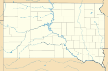 Custer County Airport | |||||||||||
| Runways | |||||||||||
| |||||||||||
Source: Federal Aviation Administration[1] | |||||||||||
Although most U.S. airports use the same three-letter location identifier for the FAA, ICAO and IATA, Custer County Airport is assigned CUT by the FAA and KCUT by the ICAO but has no designation from the IATA.[2]
Facilities
Custer County Airport covers an area of 86 acres (35 ha) which contains one asphalt paved runway (08/26) measuring 5,500 ft × 60 ft (1,676 m × 18 m).[1]
References
- FAA Airport Form 5010 for CUT PDF, effective 2007-07-05
- Circle Mapper: CUT - Custer, South Dakota
External links
- Resources for this airport:
- FAA airport information for CUT
- AirNav airport information for CUT
- FlightAware airport information and live flight tracker
- SkyVector aeronautical chart for CUT
This article about an airport in South Dakota is a stub. You can help Wikipedia by expanding it. |
Текст в блоке "Читать" взят с сайта "Википедия" и доступен по лицензии Creative Commons Attribution-ShareAlike; в отдельных случаях могут действовать дополнительные условия.
Другой контент может иметь иную лицензию. Перед использованием материалов сайта WikiSort.org внимательно изучите правила лицензирования конкретных элементов наполнения сайта.
Другой контент может иметь иную лицензию. Перед использованием материалов сайта WikiSort.org внимательно изучите правила лицензирования конкретных элементов наполнения сайта.
2019-2026
WikiSort.org - проект по пересортировке и дополнению контента Википедии
WikiSort.org - проект по пересортировке и дополнению контента Википедии