avia.wikisort.org - Aerodrome
Eureka Municipal Airport (FAA LID: 3W8) is a city-owned, public-use airport located two nautical miles (4 km) north of the central business district of Eureka, a city in McPherson County, South Dakota, United States.[1] It is included in the National Plan of Integrated Airport Systems for 2011–2015, which categorized it as a general aviation facility.[2]
Eureka Municipal Airport | |||||||||||||||
|---|---|---|---|---|---|---|---|---|---|---|---|---|---|---|---|
| |||||||||||||||
| Summary | |||||||||||||||
| Airport type | Public | ||||||||||||||
| Owner | City of Eureka | ||||||||||||||
| Serves | Eureka, South Dakota | ||||||||||||||
| Elevation AMSL | 1,935 ft / 590 m | ||||||||||||||
| Coordinates | 45°47′59″N 099°38′34″W | ||||||||||||||
| Map | |||||||||||||||
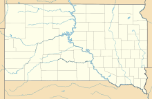 3W8 Location of airport in South Dakota | |||||||||||||||
| Runways | |||||||||||||||
| |||||||||||||||
| Statistics (2011) | |||||||||||||||
| |||||||||||||||
Source: Federal Aviation Administration[1] | |||||||||||||||
Facilities and aircraft
Eureka Municipal Airport covers an area of 183 acres (74 ha) at an elevation of 1,935 feet (590 m) above mean sea level. It has two runways: 12/30 is 3,100 by 60 feet (945 x 18 m) with an asphalt surface and 7/25 is 2,100 by 150 feet (640 x 46 m) with a turf surface. For the 12-month period ending September 12, 2011, the airport had 336 general aviation aircraft operations, an average of 28 per month. [1]
References
- FAA Airport Form 5010 for 3W8 PDF. Federal Aviation Administration. Effective May 31, 2012.
- "2011–2015 NPIAS Report, Appendix A" (PDF). National Plan of Integrated Airport Systems. Federal Aviation Administration. October 4, 2010. Archived from the original (PDF, 2.03 MB) on 2012-09-27.
External links
- Eureka (3W8) at SDDOT Airport Directory
- Aerial image as of October 1997 from USGS The National Map
- Resources for this airport:
- FAA airport information for 3W8
- AirNav airport information for 3W8
- FlightAware airport information and live flight tracker
- SkyVector aeronautical chart for 3W8
Другой контент может иметь иную лицензию. Перед использованием материалов сайта WikiSort.org внимательно изучите правила лицензирования конкретных элементов наполнения сайта.
WikiSort.org - проект по пересортировке и дополнению контента Википедии