avia.wikisort.org - Aerodrome
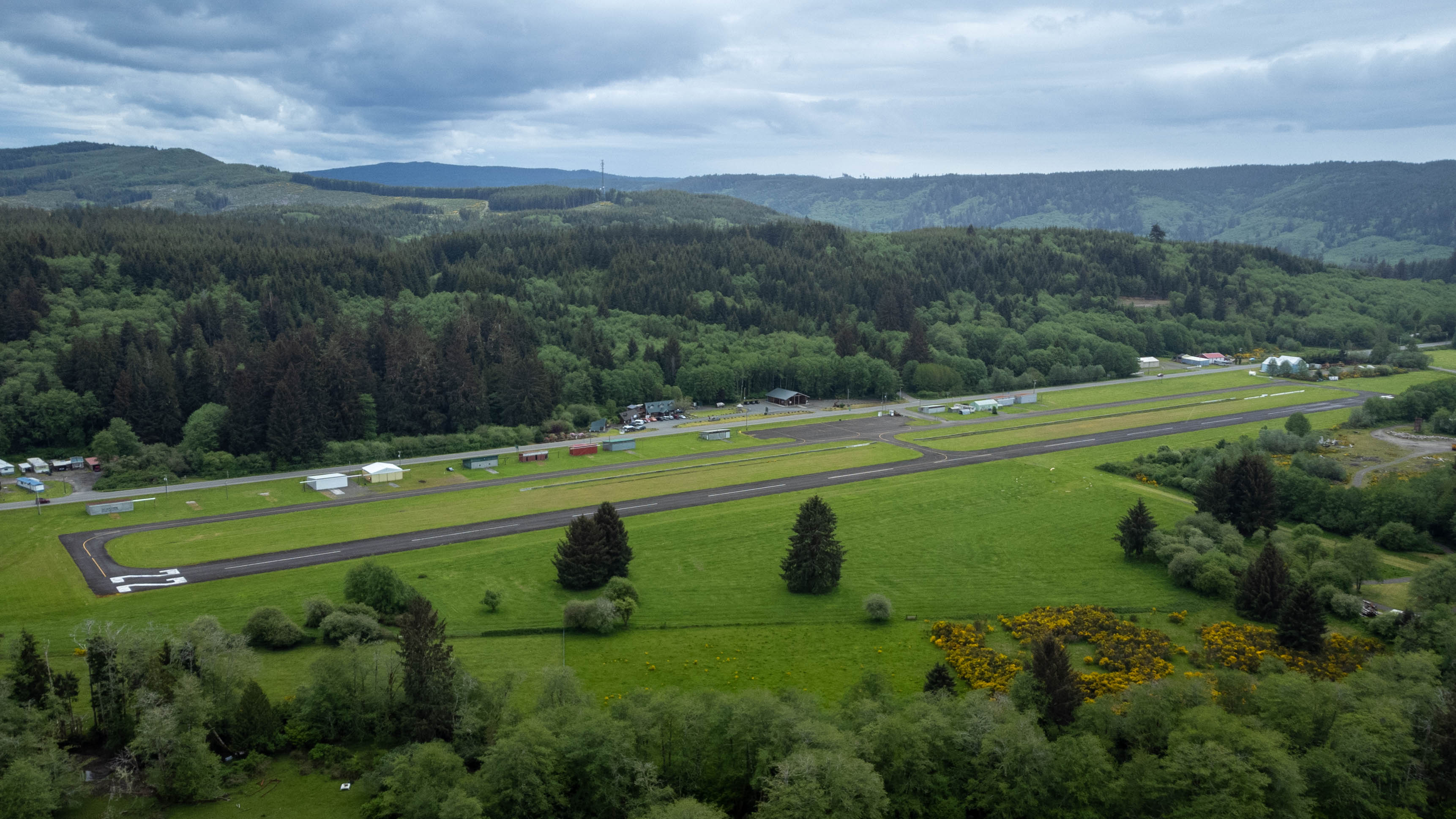
Forks Airport (FAA LID: S18) is a city-owned, public-use airport located one nautical mile (1.85 km) southwest of the central business district of Forks, a city in Clallam County, Washington, United States.[1] It was formerly known as Forks Municipal Airport.
Forks Airport | |||||||||||
|---|---|---|---|---|---|---|---|---|---|---|---|
 | |||||||||||
| Summary | |||||||||||
| Airport type | Public | ||||||||||
| Owner | City of Forks | ||||||||||
| Serves | Forks, Washington | ||||||||||
| Elevation AMSL | 299 ft / 91 m | ||||||||||
| Coordinates | 47°56′16″N 124°23′45″W | ||||||||||
| Runways | |||||||||||
| |||||||||||
| Statistics (2008) | |||||||||||
| |||||||||||
Source: Federal Aviation Administration[1] | |||||||||||
Facilities and aircraft
Forks Airport covers an area of 72 acres (29 ha) at an elevation of 299 feet (91 m) above mean sea level. It has one runway designated 4/22 with an asphalt surface measuring 2,400 by 75 feet (732 x 23 m).[1] It's equipped with medium intensity runway lighting. Approaches to both ends of this runway are visual.
For the 12-month period ending December 31, 2008, the airport had 13,600 aircraft operations, an average of 37 per day: 99.6% general aviation and 0.4% military. At that time there were 10 aircraft based at this airport: 50% single-engine, 30% helicopter and 20% ultralight.[1]
References
- FAA Airport Form 5010 for S18 PDF. Federal Aviation Administration. Effective 3 June 2010.
External links
- Forks Municipal (S18) at Washington State DOT
- Aerial image as of 19 July 1994 from USGS The National Map
- Resources for this airport:
- FAA airport information for S18
- AirNav airport information for S18
- FlightAware airport information and live flight tracker
- SkyVector aeronautical chart for S18
Другой контент может иметь иную лицензию. Перед использованием материалов сайта WikiSort.org внимательно изучите правила лицензирования конкретных элементов наполнения сайта.
WikiSort.org - проект по пересортировке и дополнению контента Википедии