avia.wikisort.org - Aerodrome
Franklin Flying Field (FAA LID: 3FK) is a privately owned, public use airport located three nautical miles (6 km) south of the central business district of Franklin, a city in Johnson County, Indiana, United States.[1]
Franklin Flying Field | |||||||||||
|---|---|---|---|---|---|---|---|---|---|---|---|
| |||||||||||
| Summary | |||||||||||
| Airport type | Public use | ||||||||||
| Owner | Siherb Aviation Corp | ||||||||||
| Serves | Franklin, Indiana | ||||||||||
| Elevation AMSL | 740 ft / 226 m | ||||||||||
| Coordinates | 39°25′35″N 086°03′30″W | ||||||||||
| Map | |||||||||||
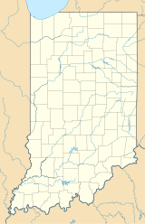 3FK Location of airport in Indiana | |||||||||||
| Runways | |||||||||||
| |||||||||||
| Statistics | |||||||||||
| |||||||||||
Source: Federal Aviation Administration[1] | |||||||||||
Facilities and aircraft
Franklin Flying Field covers an area of 129 acres (52 ha) at an elevation of 740 feet (226 m) above mean sea level. It has one runway designated 3/21 with an asphalt surface measuring 2,400 by 35 feet (732 x 11 m).[1]
There are 43 aircraft based at this airport: 95.3% single-engine, 2.3% multi-engine, and 2.3% helicopter.[1]
References
- FAA Airport Form 5010 for 3FK PDF. Federal Aviation Administration. Effective November 15, 2012.
External links
- Aerial photo from Indiana DOT at the Wayback Machine (archived August 15, 2010)
- Aerial image as of March 1998 from USGS The National Map
- Resources for this airport:
- FAA airport information for 3FK
- AirNav airport information for 3FK
- FlightAware airport information and live flight tracker
- SkyVector aeronautical chart for 3FK
Текст в блоке "Читать" взят с сайта "Википедия" и доступен по лицензии Creative Commons Attribution-ShareAlike; в отдельных случаях могут действовать дополнительные условия.
Другой контент может иметь иную лицензию. Перед использованием материалов сайта WikiSort.org внимательно изучите правила лицензирования конкретных элементов наполнения сайта.
Другой контент может иметь иную лицензию. Перед использованием материалов сайта WikiSort.org внимательно изучите правила лицензирования конкретных элементов наполнения сайта.
2019-2026
WikiSort.org - проект по пересортировке и дополнению контента Википедии
WikiSort.org - проект по пересортировке и дополнению контента Википедии