avia.wikisort.org - Aerodrome
Frieda River Airport (IATA: FAQ[2], ICAO: AYFR) is an airfield serving the Frieda River area in Papua New Guinea.[1] It is located near the border between the provinces of West Sepik (Sandaun) and East Sepik. The area has a gold and copper mine known as the Frieda River Project.[3] The airfield is located 428 nautical miles (793 km; 493 mi) northwest of Port Moresby, the capital and largest city of Papua New Guinea.[4]
Frieda River Airport | |||||||||||
|---|---|---|---|---|---|---|---|---|---|---|---|
| |||||||||||
| Summary | |||||||||||
| Airport type | Public | ||||||||||
| Location | Frieda River, Papua New Guinea | ||||||||||
| Elevation AMSL | 200 ft / 61 m | ||||||||||
| Coordinates | 04°36.54′S 141°57.62′E | ||||||||||
| Maps | |||||||||||
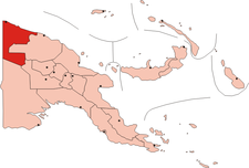 West Sepik (Sandaun) province in PNG | |||||||||||
 Frieda River Airport | |||||||||||
| Runways | |||||||||||
| |||||||||||
Source: PNG Airstrip Guide[1] | |||||||||||
Facilities
The airfield resides at an elevation of 200 feet (61 m) above mean sea level. It has one runway designated 03/21 which is 640 metres (2,100 ft) long.[1]
References
- PNG Airstrip Guide. August 2005.
- Accident history for FAQ at Aviation Safety Network
- "Xstrata buys into Pacific PNG gold". Australian Associated Press Pty Limited (AAP). 22 Jan 2007. Retrieved 2 Mar 2010.
- "Heading and distance from Port Moresby to Frieda River Airport". Great Circle Mapper. Retrieved 2 Mar 2010.
This article about a Papua New Guinean building or structure related topic is a stub. You can help Wikipedia by expanding it. |
Текст в блоке "Читать" взят с сайта "Википедия" и доступен по лицензии Creative Commons Attribution-ShareAlike; в отдельных случаях могут действовать дополнительные условия.
Другой контент может иметь иную лицензию. Перед использованием материалов сайта WikiSort.org внимательно изучите правила лицензирования конкретных элементов наполнения сайта.
Другой контент может иметь иную лицензию. Перед использованием материалов сайта WikiSort.org внимательно изучите правила лицензирования конкретных элементов наполнения сайта.
2019-2025
WikiSort.org - проект по пересортировке и дополнению контента Википедии
WikiSort.org - проект по пересортировке и дополнению контента Википедии