avia.wikisort.org - Aerodrome
Genesee County Airport (ICAO: KGVQ, FAA LID: GVQ, formerly 3G8) is a county-owned, public-use airport in Genesee County, New York, United States.[1] It is located two nautical miles (4 km) north of the central business district of Batavia,[1] a city located within the Town of Batavia.
Genesee County Airport | |||||||||||
|---|---|---|---|---|---|---|---|---|---|---|---|
| |||||||||||
| Summary | |||||||||||
| Airport type | Public | ||||||||||
| Owner | Genesee County | ||||||||||
| Operator | Genesee County Highway Department | ||||||||||
| Serves | Batavia, New York | ||||||||||
| Elevation AMSL | 914 ft / 279 m | ||||||||||
| Coordinates | 43°01′54″N 078°10′11″W | ||||||||||
| Website | www.co.genesee.ny.us/... | ||||||||||
| Map | |||||||||||
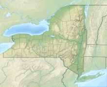 GVQ Location of airport in New York / United States  GVQ GVQ (the United States) | |||||||||||
| Runways | |||||||||||
| |||||||||||
| Statistics (2009) | |||||||||||
| |||||||||||
Source: Federal Aviation Administration[1] | |||||||||||
This airport is included in the National Plan of Integrated Airport Systems for 2011–2015, which categorized it as a general aviation reliever airport.[2] Although many U.S. airports use the same three-letter location identifier for the FAA and IATA, this airport is assigned GVQ by the FAA[1] but has no designation from the IATA.[3][4]
Facilities and aircraft
Genesee County Airport covers an area of 326 acres (132 ha) at an elevation of 914 feet (279 m) above mean sea level. It has one runway designated 10/28 with an asphalt surface measuring 5,500 by 100 feet (1,676 x 30 m).[1]
For the 12-month period ending September 18, 2009, the airport had 40,000 aircraft operations, an average of 109 per day: 96% general aviation, 2% air taxi, and 2% military. At that time there were 48 aircraft based at this airport: 85% single-engine, 4% multi-engine, 6% jet and 4% helicopter.[1]
Nearby airports
Nearby airports with instrument approach procedures include:[5]
- 9G6 – Pine Hill Airport (10 nm NW)
- 5G0 – Le Roy Airport (11 nm E)
- 9G3 – Akron Airport (14 nm W)
- 7G0 – Ledgedale Airpark (14 nm NE)
- ROC – Greater Rochester International Airport (22 nm E)
References
- FAA Airport Form 5010 for GVQ PDF. Federal Aviation Administration. Effective April 8, 2010.
- "Appendix A: List of NPIAS Airports with 5-Year Forecast Activity and Development Cost". National Plan of Integrated Airport Systems (NPIAS) Reports. Federal Aviation Administration. October 4, 2010. Archived from the original on 2012-10-27.
- "IATA Airport Code Search (GVQ)". International Air Transport Association. Retrieved June 17, 2013.
- "Genesee County Airport (IATA: none, ICAO: KGVQ, FAA: GVQ)". Great Circle Mapper. Retrieved April 15, 2010.
- "KGVQ – Genesee County Airport". AirNav.com. Retrieved June 17, 2013.
External links
- Airport page at Genesee County website
- Genesee County Airport (GVQ) at NYSDOT Airport Directory
- Aerial image as of April 1994 from USGS The National Map
- FAA Terminal Procedures for GVQ, effective October 6, 2022
- Resources for this airport:
- FAA airport information for GVQ
- AirNav airport information for KGVQ
- FlightAware airport information and live flight tracker
- NOAA/NWS weather observations: current, past three days
- SkyVector aeronautical chart, Terminal Procedures
Другой контент может иметь иную лицензию. Перед использованием материалов сайта WikiSort.org внимательно изучите правила лицензирования конкретных элементов наполнения сайта.
WikiSort.org - проект по пересортировке и дополнению контента Википедии