avia.wikisort.org - Aerodrome
Grayling Army Airfield (ICAO: KGOV, FAA LID: GOV) is a public/military use airport located one nautical mile (1.85 km) northwest of the central business district of Grayling, in Crawford County, Michigan, United States. It is owned by United States Army.[1] The airfield is located 7 miles (11 km) northeast of the main cantonment area of Camp Grayling. It is included in the Federal Aviation Administration (FAA) National Plan of Integrated Airport Systems for 2017–2021, in which it is categorized as a general aviation facility.[2]
Grayling AAF | |||||||||||||||
|---|---|---|---|---|---|---|---|---|---|---|---|---|---|---|---|
 | |||||||||||||||
| Summary | |||||||||||||||
| Airport type | Public / military | ||||||||||||||
| Owner | United States Army | ||||||||||||||
| Location | Grayling, Michigan | ||||||||||||||
| Elevation AMSL | 1,158 ft / 353 m | ||||||||||||||
| Coordinates | 44°40′49″N 084°43′44″W | ||||||||||||||
| Map | |||||||||||||||
 GOV Location of airport in Michigan  GOV GOV (the United States) | |||||||||||||||
| Runways | |||||||||||||||
| |||||||||||||||
| Statistics (2008) | |||||||||||||||
| |||||||||||||||
Source: Federal Aviation Administration[1] | |||||||||||||||
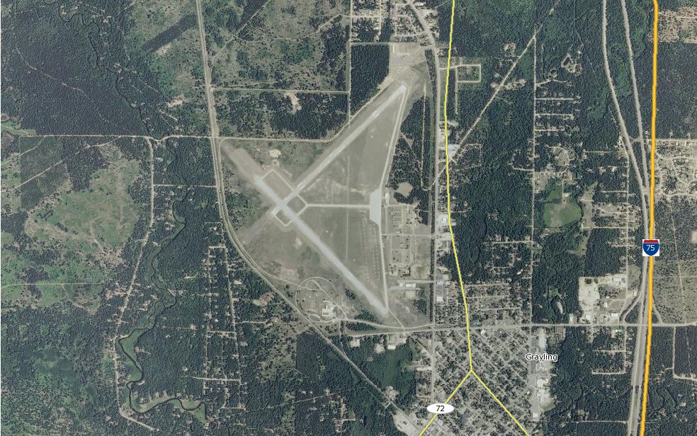
Grayling AAF covers an area of 923 acres (374 ha) at an elevation of 1,158 feet (353 m) above mean sea level. For the 12-month period ending December 31, 2008, the airport had 4,691 aircraft operations, an average of 10 per day: 63% general aviation and 37% military.[1]
Although most U.S. airports use the same three-letter location identifier for the FAA and IATA, this airport is assigned GOV by the FAA but has no designation from the IATA[3] (which assigned GOV to Gove Airport in Australia[4]).
Facilities
The airport is staffed from dawn until dusk. The 29,000-square-foot (2,700 m2) parking area can accommodate fixed-wing aircraft with parking for 100 helicopters, 50 with cement pads with a total of 70 tie downs. The control tower was recently upgraded to a STVS (Small Tower Voice Switch) system with positions in three different locations. There is an 800-square-foot (74 m2) operations building which includes an operations center, flight planning room, safety office, commander's office, and a weather room. Additionally, the airfield contains a 6,400-square-foot (590 m2) maintenance hangar, crash rescue barn and NAVAIDS which include TVOR, NDB, VASI and REIL.
Runways
The airfield consists of two 5000x150-foot runways with 1,200-foot (370 m) overrun and 50-foot (15 m) wide connecting taxiways.
- Runway 5/23: 5,000 x 150 ft (1,524 x 46 m), surface: concrete
- Runway 14/32: 5,005 x 150 ft (1526 x 46 m), surface: asphalt
Runway 5/23 and taxiways A/D/E are closed during the winter months, since there is no snow removal on these surfaces.
Transit
- The airport is accessible by road from M-93 and BL I-75, and is close to M-72 and I-75.
See also
References
![]() This article incorporates public domain material from the Air Force Historical Research Agency website https://www.afhra.af.mil/.
This article incorporates public domain material from the Air Force Historical Research Agency website https://www.afhra.af.mil/.
- FAA Airport Form 5010 for GOV PDF. Federal Aviation Administration. effective 17 December 2009.
- "List of NPIAS Airports" (PDF). FAA.gov. Federal Aviation Administration. 21 October 2016. Retrieved 25 November 2016.
- KGOV - Grayling, Michigan - Grayling Army Airfield. Great Circle Mapper. Accessed 25 January 2010.
- GOV / YPGV - Gove, Australia. Great Circle Mapper. Accessed 25 January 2010.
External links
- Grayling Army Airfield page at Michigan National Guard website
- Aerial photo as of 30 April 1999 from USGS The National Map
- "Grayling Army Airfield (GOV)" (PDF). (52.4 KiB) page at Michigan Airport Directory
- FAA Terminal Procedures for GOV, effective August 11, 2022
- Resources for this airport:
- FAA airport information for GOV
- AirNav airport information for KGOV
- FlightAware airport information and live flight tracker
- NOAA/NWS weather observations: current, past three days
- SkyVector aeronautical chart, Terminal Procedures
Другой контент может иметь иную лицензию. Перед использованием материалов сайта WikiSort.org внимательно изучите правила лицензирования конкретных элементов наполнения сайта.
WikiSort.org - проект по пересортировке и дополнению контента Википедии