avia.wikisort.org - Aerodrome
Hohenfels Army Airfield (ICAO: ETIH) is a military airport near Hohenfels, a small town in Bavaria, Germany. It is part of the Hohenfels Training Area, which hosts the U.S. Army's Joint Multinational Readiness Center (JMRC). As part of JMRC, the airfield is used by helicopters in support of exercises held at the Hohenfels Training Area.[2] It is also used as a refueling stop by Army helicopters transiting through Europe.[3]
Hohenfels Army Airfield | |||||||||||
|---|---|---|---|---|---|---|---|---|---|---|---|
 | |||||||||||
| Summary | |||||||||||
| Airport type | Military | ||||||||||
| Operator | |||||||||||
| Elevation AMSL | 1,455 ft / 443 m | ||||||||||
| Coordinates | 49°12.99′N 11°50.17′E | ||||||||||
| Map | |||||||||||
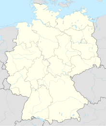 Hohenfels AAF Location in Germany | |||||||||||
| Runways | |||||||||||
| |||||||||||
Source: DoD FLIP[1] | |||||||||||
References
- DoD Flight Information Publication (Enroute) - Supplement Europe North Africa and Middle East. St. Louis, Missouri: National Geospatial-Intelligence Agency. 2021. pp. B-224.
- "Afternoon Training Flights for 101st MEDEVAC". DVIDS. 2021-02-21. Retrieved 2021-08-30.
{{cite web}}: CS1 maint: url-status (link) - Joint Multinational Readiness Center [@HohenfelsJMRC] (2021-05-28). "U.S. Army AH-64 #Apache Helicopters belonging to the 12th Combat Aviation Brigade made a stop for fuel at JMRC while enroute to Hungary for #SaberGuardian 21 yesterday" (Tweet). Retrieved 2021-08-30 – via Twitter.
This article about an airport in Germany is a stub. You can help Wikipedia by expanding it. |
Текст в блоке "Читать" взят с сайта "Википедия" и доступен по лицензии Creative Commons Attribution-ShareAlike; в отдельных случаях могут действовать дополнительные условия.
Другой контент может иметь иную лицензию. Перед использованием материалов сайта WikiSort.org внимательно изучите правила лицензирования конкретных элементов наполнения сайта.
Другой контент может иметь иную лицензию. Перед использованием материалов сайта WikiSort.org внимательно изучите правила лицензирования конкретных элементов наполнения сайта.
2019-2026
WikiSort.org - проект по пересортировке и дополнению контента Википедии
WikiSort.org - проект по пересортировке и дополнению контента Википедии