avia.wikisort.org - Aerodrome
Jake Garn Airport (FAA LID: 17U) was a privately owned public-use airport 3 nautical miles (6 km) southwest of the central business district of Eagle Mountain, a city in Utah County, Utah, United States. The airport opened in May 2000[1] and closed in 2018.
Jake Garn Airport | |||||||||||
|---|---|---|---|---|---|---|---|---|---|---|---|
| |||||||||||
| Summary | |||||||||||
| Airport type | Public use | ||||||||||
| Owner | Eagle Mountain Properties, LLC | ||||||||||
| Serves | Eagle Mountain, Utah | ||||||||||
| Elevation AMSL | 4,845 ft / 1,477 m | ||||||||||
| Coordinates | 40°15′49″N 112°01′16″W | ||||||||||
| Map | |||||||||||
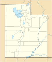 17U Location of airport in Utah | |||||||||||
| Runways | |||||||||||
| |||||||||||
| Statistics (2007) | |||||||||||
| |||||||||||
Source: Federal Aviation Administration[1] | |||||||||||
Facilities and aircraft
Jake Garn Airport covered an area of 438 acres (177 ha) at an elevation of 4,845 feet (1,477 m) above mean sea level. It had one runway designated 17/35 with an asphalt and gravel surface measuring 5,000 by 50 feet (1,524 by 15 m).[1]
In 2007 the airport had an average of 82 general aviation aircraft operations per week, of which 95% were local and 5% were transient.[1]
References
- FAA Airport Form 5010 for 17U PDF. Federal Aviation Administration. Effective August 27, 2009.
External links
- Aerial image of site in 1997, prior to construction of airport from USGS The National Map
- Aeronautical chart at SkyVector
Текст в блоке "Читать" взят с сайта "Википедия" и доступен по лицензии Creative Commons Attribution-ShareAlike; в отдельных случаях могут действовать дополнительные условия.
Другой контент может иметь иную лицензию. Перед использованием материалов сайта WikiSort.org внимательно изучите правила лицензирования конкретных элементов наполнения сайта.
Другой контент может иметь иную лицензию. Перед использованием материалов сайта WikiSort.org внимательно изучите правила лицензирования конкретных элементов наполнения сайта.
2019-2025
WikiSort.org - проект по пересортировке и дополнению контента Википедии
WikiSort.org - проект по пересортировке и дополнению контента Википедии