avia.wikisort.org - Aerodrome
Kamina Air Base (ICAO: FZSA) is a military airport located near Kamina in the Democratic Republic of the Congo.[1]
Kamina Air Base | |||||||||||||||
|---|---|---|---|---|---|---|---|---|---|---|---|---|---|---|---|
 | |||||||||||||||
| Summary | |||||||||||||||
| Airport type | Military | ||||||||||||||
| Operator | Air Force of the Democratic Republic of the Congo | ||||||||||||||
| Location | Kamina, Democratic Republic of the Congo | ||||||||||||||
| Elevation AMSL | 3,543 ft / 1,080 m | ||||||||||||||
| Coordinates | 08°38′31″S 025°15′10″E | ||||||||||||||
| Runways | |||||||||||||||
| |||||||||||||||
Sources:[1] | |||||||||||||||
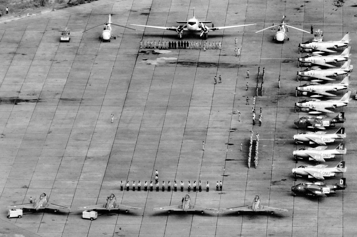
It was built as part of the Belgian near-national-redoubt concept after World War II.[2] It accommodated ONUC military aircraft during the Congo Crisis.
Facilities
The airport resides at an elevation of 3,543 feet (1,080 m) above mean sea level. It has two runways, each with an asphalt surface measuring 2,700 by 45 metres (8,858 ft × 148 ft).[1]
See also
- Kamina Airport
- Air Force of the Democratic Republic of the Congo
References
- Airport information for FZSA from DAFIF (effective October 2006)
- David Isby and Charles Kamps Jr., Armies of NATO's Central Front, Jane's Publishing Company, 1985.
На других языках
- [en] Kamina Air Base
[fr] Base aérienne de Kamina
@media all and (max-width:720px){body.skin-minerva .mw-parser-output *[class*="infobox"] table{display:table}body.skin-minerva .mw-parser-output *[class*="infobox"] caption{display:table-caption}}Текст в блоке "Читать" взят с сайта "Википедия" и доступен по лицензии Creative Commons Attribution-ShareAlike; в отдельных случаях могут действовать дополнительные условия.
Другой контент может иметь иную лицензию. Перед использованием материалов сайта WikiSort.org внимательно изучите правила лицензирования конкретных элементов наполнения сайта.
Другой контент может иметь иную лицензию. Перед использованием материалов сайта WikiSort.org внимательно изучите правила лицензирования конкретных элементов наполнения сайта.
2019-2026
WikiSort.org - проект по пересортировке и дополнению контента Википедии
WikiSort.org - проект по пересортировке и дополнению контента Википедии