avia.wikisort.org - Aerodrome
La Porte Municipal Airport (IATA: LPO, ICAO: KPPO, FAA LID: PPO) is a city-owned public-use airport located three miles (5 km) south of the central business district of La Porte, a city in La Porte County, Indiana, United States.[2]
La Porte Municipal Airport | |||||||||||||||
|---|---|---|---|---|---|---|---|---|---|---|---|---|---|---|---|
| |||||||||||||||
| Summary | |||||||||||||||
| Airport type | Public | ||||||||||||||
| Owner | La Porte Airport Authority | ||||||||||||||
| Serves | La Porte, Indiana | ||||||||||||||
| Opened | April 1940[1] | ||||||||||||||
| Elevation AMSL | 812 ft / 247 m | ||||||||||||||
| Map | |||||||||||||||
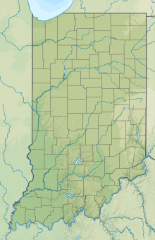
 PPO Location of airport in Indiana/United States  PPO PPO (the United States) | |||||||||||||||
| Runways | |||||||||||||||
| |||||||||||||||
| Statistics (2005) | |||||||||||||||
| |||||||||||||||
Source: Federal Aviation Administration[2] | |||||||||||||||
Although most U.S. airports use the same three-letter location identifier for the FAA and IATA, La Porte Municipal Airport is assigned PPO by the FAA and LPO by the IATA. The airport's ICAO identifier is KPPO.[3]
Facilities and aircraft
La Porte Municipal Airport covers an area of 188 acres (76 ha) which contains two asphalt paved runways: 2/20 at 5,000 x 75 ft (1,524 x 23 m) and 14/32 measuring 2,800 x 60 ft (853 x 18 m).[2]
For the 12-month period ending December 31, 2005, the airport had 15,416 aircraft operations, an average of 42 per day: 99.7% general aviation and 0.3% air taxi. There are 78 aircraft based at this airport: 91% single-engine, 5% multi-engine and 4% jet.[2]
References
- "La Porte Municipal Airport". AirNav, LLC. Retrieved 2016-10-18.
- FAA Airport Form 5010 for PPO PDF, effective 2007-12-20
- Great Circle Mapper: LPO / KPPO - La Porte, Indiana (La Porte Municipal Airport)
External links
- Airport page at City of La Porte web site
- Resources for this airport:
- FAA airport information for PPO
- AirNav airport information for PPO
- ASN accident history for LPO
- FlightAware airport information and live flight tracker
- SkyVector aeronautical chart for PPO
Другой контент может иметь иную лицензию. Перед использованием материалов сайта WikiSort.org внимательно изучите правила лицензирования конкретных элементов наполнения сайта.
WikiSort.org - проект по пересортировке и дополнению контента Википедии