avia.wikisort.org - Aerodrome
Ladysmith Airport (IATA: LAY, ICAO: FALY) is an airport serving Ladysmith,[1] a town in the KwaZulu-Natal province in South Africa.
Ladysmith Airport | |||||||||||
|---|---|---|---|---|---|---|---|---|---|---|---|
 Ladysmith Airport seen from Platrand | |||||||||||
| |||||||||||
| Summary | |||||||||||
| Airport type | Public | ||||||||||
| Owner | JetVision Holdings Pty Ltd | ||||||||||
| Operator | JetVision Airports Pty Ltd | ||||||||||
| Location | Ladysmith, KwaZulu-Natal, South Africa | ||||||||||
| Elevation AMSL | 3,548 ft / 1,081 m | ||||||||||
| Coordinates | 28°34.8′S 029°45.2′E | ||||||||||
| Website | www.jetvisionairways.com | ||||||||||
| Map | |||||||||||
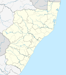 LAY Location in KwaZulu-Natal | |||||||||||
| Runways | |||||||||||
| |||||||||||
Facilities
The airport is located on the outskirts of town just below Platrand at 28°34′48″S 29°45′10″E at an elevation of 3,548 feet (1,081 m) above mean sea level. It has one runway designated 11/29 with an asphalt surface measuring 1,200 by 15 metres (3,937 ft × 49 ft).[1] NDB is LY397.5 and VOR is LYV116.5. The airport is now managed by JetVision Airports Pty Ltd,
References
- "Aerodrome chart for FALY – LADYSMITH" (PDF). South African Civil Aviation Authority. 8 July 2004. Archived from the original (PDF) on 19 July 2011.
- Airport information for FALY from DAFIF (effective October 2006)
- Airport information for LAY at Great Circle Mapper. Source: DAFIF (effective October 2006).
External links
- Accident history for LAY at Aviation Safety Network
Текст в блоке "Читать" взят с сайта "Википедия" и доступен по лицензии Creative Commons Attribution-ShareAlike; в отдельных случаях могут действовать дополнительные условия.
Другой контент может иметь иную лицензию. Перед использованием материалов сайта WikiSort.org внимательно изучите правила лицензирования конкретных элементов наполнения сайта.
Другой контент может иметь иную лицензию. Перед использованием материалов сайта WikiSort.org внимательно изучите правила лицензирования конкретных элементов наполнения сайта.
2019-2026
WikiSort.org - проект по пересортировке и дополнению контента Википедии
WikiSort.org - проект по пересортировке и дополнению контента Википедии