avia.wikisort.org - Aerodrome
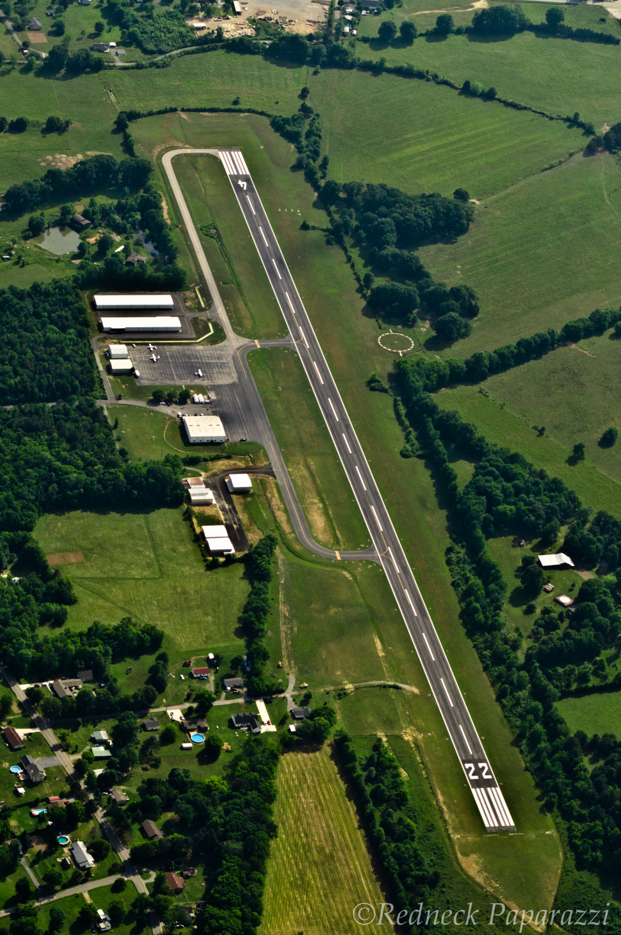
Marion County Airport (IATA: APT, ICAO: KAPT, FAA LID: APT), also known as Brown Field, is a county-owned, public-use airport located four nautical miles (7 km) southeast of the central business district of Jasper, a town in Marion County, Tennessee, United States.[1]
Marion County Airport Brown Field | |||||||||||
|---|---|---|---|---|---|---|---|---|---|---|---|
| |||||||||||
| Summary | |||||||||||
| Airport type | Public | ||||||||||
| Owner | Marion County | ||||||||||
| Serves | Jasper, Tennessee | ||||||||||
| Elevation AMSL | 641 ft / 195 m | ||||||||||
| Coordinates | 35°03′38″N 085°35′07″W | ||||||||||
| Map | |||||||||||
 APT Location of airport in Tennessee | |||||||||||
| Runways | |||||||||||
| |||||||||||
| Statistics (2009) | |||||||||||
| |||||||||||
Source: Federal Aviation Administration[1] | |||||||||||
Facilities and aircraft
Marion County Airport covers an area of 86 acres (35 ha) at an elevation of 641 feet (195 m) above mean sea level. It has one runway designated 4/22 with an asphalt surface measuring 3,500 by 75 feet (1,067 x 23 m).[1]
For the 12-month period ending June 25, 2009, the airport had 4,480 aircraft operations, an average of 12 per day: 98% general aviation and 2% military. At that time there were 12 aircraft based at this airport: 92% single-engine and 8% helicopter.[1]
References
- FAA Airport Form 5010 for APT PDF. Federal Aviation Administration. Effective 11 February 2010.
External links
- Aerial photo as of 19 May 2012
- Aerial photo as of 21 March 1997 from USGS The National Map
- FAA Terminal Procedures for APT, effective May 19, 2022
- Resources for this airport:
- FAA airport information for APT
- AirNav airport information for APT
- ASN accident history for APT
- FlightAware airport information and live flight tracker
- SkyVector aeronautical chart for APT
Текст в блоке "Читать" взят с сайта "Википедия" и доступен по лицензии Creative Commons Attribution-ShareAlike; в отдельных случаях могут действовать дополнительные условия.
Другой контент может иметь иную лицензию. Перед использованием материалов сайта WikiSort.org внимательно изучите правила лицензирования конкретных элементов наполнения сайта.
Другой контент может иметь иную лицензию. Перед использованием материалов сайта WikiSort.org внимательно изучите правила лицензирования конкретных элементов наполнения сайта.
2019-2025
WikiSort.org - проект по пересортировке и дополнению контента Википедии
WikiSort.org - проект по пересортировке и дополнению контента Википедии