avia.wikisort.org - Aerodrome
Maryland Airport (FAA LID: 2W5) is a privately owned, public use airport located four miles (6 km) east of the central business district of Indian Head, in Charles County, Maryland, United States.[1]
Maryland Airport | |||||||||||
|---|---|---|---|---|---|---|---|---|---|---|---|
| |||||||||||
| Summary | |||||||||||
| Airport type | Public | ||||||||||
| Owner | PSM Holdings, LLC. | ||||||||||
| Operator | PSM Holdings, LLC. | ||||||||||
| Serves | Indian Head, Maryland | ||||||||||
| Elevation AMSL | 170 ft / 52 m | ||||||||||
| Map | |||||||||||
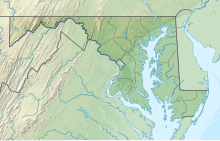
 2W5 Location of airport in Maryland / United States  2W5 2W5 (the United States) | |||||||||||
| Runways | |||||||||||
| |||||||||||
| Statistics (2013) | |||||||||||
| |||||||||||
Source: Federal Aviation Administration[1] | |||||||||||
Facilities and aircraft
Maryland Airport covers an area of 377 acres (153 ha) which contains one operational runway: 2/20 with a 3,740 x 75 ft asphalt surface. For the 12-month period ending September 19, 2013, the airport had 17,020 aircraft operations, an average of 47 per day: 88% local general aviation, 6% transient general aviation, 6% military and <1% air taxi.[1] Phase 3 of the airport's expansion will include extending the runway to 4,300 feet, along with construction of a parallel taxiway, a ramp to accommodate 75 planes, an access road to Bumpy Oak Road, and a new terminal.[2]
See also
References
- FAA Airport Form 5010 for 2W5 PDF, effective 2013-09-19
- www.somdnews.com https://archive.today/20140415180915/http://www.somdnews.com/article/20131023/NEWS/131029717/1075/after-years-on-runway-airport-project-takes-to-sky&template=southernMaryland. Archived from the original on 2014-04-15.
{{cite web}}: Missing or empty|title=(help)
External links
- Maryland Airport at Maryland Office of Regional Aviation Assistance
- Resources for this airport:
- FAA airport information for 2W5
- AirNav airport information for 2W5
- FlightAware airport information and live flight tracker
- SkyVector aeronautical chart for 2W5
Другой контент может иметь иную лицензию. Перед использованием материалов сайта WikiSort.org внимательно изучите правила лицензирования конкретных элементов наполнения сайта.
WikiSort.org - проект по пересортировке и дополнению контента Википедии