avia.wikisort.org - Aerodrome
Miller Municipal Airport (ICAO: KMKA, FAA LID: MKA) is a city-owned, public-use airport located two nautical miles (4 km) east of the central business district of Miller, a city in Hand County, South Dakota, United States.[1] It is included in the National Plan of Integrated Airport Systems for 2011–2015, which categorized it as a general aviation facility.[2]
Miller Municipal Airport | |||||||||||
|---|---|---|---|---|---|---|---|---|---|---|---|
| |||||||||||
| Summary | |||||||||||
| Airport type | Public | ||||||||||
| Owner | City of Miller | ||||||||||
| Serves | Miller, South Dakota | ||||||||||
| Elevation AMSL | 1,570 ft / 479 m | ||||||||||
| Coordinates | 44°31′31″N 098°57′29″W | ||||||||||
| Map | |||||||||||
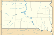 MKA Location of airport in South Dakota | |||||||||||
| Runways | |||||||||||
| |||||||||||
| Statistics (2012) | |||||||||||
| |||||||||||
Source: Federal Aviation Administration[1] | |||||||||||
Although many U.S. airports use the same three-letter location identifier for the FAA and IATA, this airport is assigned MKA by the FAA[1] but has no designation from the IATA[3] (which assigned MKA to Marianske Lazne Airport in Marianske Lazne, Czech Republic).[4][5]
Facilities and aircraft
Miller Municipal Airport covers an area of 252 acres (102 ha) at an elevation of 1,570 feet (479 m) above mean sea level. It has one runway designated 15/33 with an asphalt surface measuring 3,600 by 60 feet (1,097 x 18 m).[1]
For the 12-month period ending April 19, 2012, the airport had 7,980 general aviation aircraft operations, an average of 21 per day. At that time there were 11 aircraft based at this airport: 91% single-engine and 9% multi-engine.[1]
References
- FAA Airport Form 5010 for MKA PDF. Federal Aviation Administration. Effective November 15, 2012.
- "2011–2015 NPIAS Report, Appendix A" (PDF). National Plan of Integrated Airport Systems. Federal Aviation Administration. October 4, 2010. Archived from the original (PDF, 2.03 MB) on September 27, 2012.
- "Miller Municipal Airport (IATA: none, ICAO: KMKA, FAA: MKA)". Great Circle Mapper. Retrieved June 9, 2013.
- "IATA Airport Code Search (MKA: Marianske Lazne)". International Air Transport Association. Retrieved June 9, 2013.
- "Mariánské Lázne Airport, Czech Republic (IATA: MKA, ICAO: LKMR)". Aviation Safety Network. Retrieved June 9, 2013.
External links
- Miller Airport (MKA) at SDDOT Airport Directory
- Aerial image as of June 1996 from USGS The National Map
- FAA Terminal Procedures for MKA, effective May 19, 2022
- Resources for this airport:
- FAA airport information for MKA
- AirNav airport information for KMKA
- FlightAware airport information and live flight tracker
- SkyVector aeronautical chart for KMKA
Другой контент может иметь иную лицензию. Перед использованием материалов сайта WikiSort.org внимательно изучите правила лицензирования конкретных элементов наполнения сайта.
WikiSort.org - проект по пересортировке и дополнению контента Википедии