avia.wikisort.org - Aerodrome
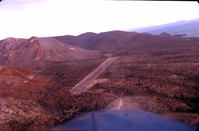
Mulegé Airstrip or Mulegé Municipal Airstrip (IATA: MUG, ICAO: MMMG) is a public dirt airstrip located 3 kilometres (1.9 mi) northeast of the town of Mulegé, in the Municipality of Mulegé, Baja California Sur state, northwest Mexico.
Mulegé Airstrip | |||||||||||
|---|---|---|---|---|---|---|---|---|---|---|---|
| |||||||||||
| Summary | |||||||||||
| Airport type | Public, General aviation | ||||||||||
| Serves | Mulegé | ||||||||||
| Location | Mulegé Municipality, Baja California Sur, Mexico | ||||||||||
| Elevation AMSL | 124 ft / 38 m | ||||||||||
| Coordinates | 26°54′21″N 111°58′14″W | ||||||||||
| Map | |||||||||||
 MUG Location of airport in Baja California Sur | |||||||||||
| Runways | |||||||||||
| |||||||||||
| Statistics (2016) | |||||||||||
| |||||||||||
Source: Dirección General de Aeronáutica Civil | |||||||||||
It is on the north bank of the Mulegé River, 3 kilometres (1.9 mi) from the Gulf of California coast.
The airstrip is used solely for general aviation purposes. It is a secondary airport to the El Gallito Airstrip, which is the most used, due to better quality installations and safety conditions.
External links
This article about a Mexican airport is a stub. You can help Wikipedia by expanding it. |
Текст в блоке "Читать" взят с сайта "Википедия" и доступен по лицензии Creative Commons Attribution-ShareAlike; в отдельных случаях могут действовать дополнительные условия.
Другой контент может иметь иную лицензию. Перед использованием материалов сайта WikiSort.org внимательно изучите правила лицензирования конкретных элементов наполнения сайта.
Другой контент может иметь иную лицензию. Перед использованием материалов сайта WikiSort.org внимательно изучите правила лицензирования конкретных элементов наполнения сайта.
2019-2025
WikiSort.org - проект по пересортировке и дополнению контента Википедии
WikiSort.org - проект по пересортировке и дополнению контента Википедии