avia.wikisort.org - Aerodrome
Mutukula Airport is an airport serving the town of Mutukula in the Rakai District of the Central Region of Uganda.
Mutukula Airport | |||||||||||
|---|---|---|---|---|---|---|---|---|---|---|---|
| |||||||||||
| Summary | |||||||||||
| Airport type | Civilian and military | ||||||||||
| Owner | Civil Aviation Authority of Uganda | ||||||||||
| Serves | Mutukula, Uganda | ||||||||||
| Elevation AMSL | 3,820 ft / 1,164 m | ||||||||||
| Coordinates | 0°55′30″S 31°27′00″E | ||||||||||
| Map | |||||||||||
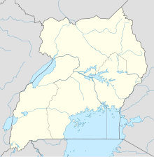 Mutukula Location of the airport in Uganda | |||||||||||
| Runways | |||||||||||
| |||||||||||
The airport is on the Masaka-Kakuto road,[3] 8 kilometres (5.0 mi) north of Mutukala, which straddles the Ugandan border with Tanzania. 2010 satellite imagery shows the runway obstructed with brush.[1]
See also
- Transport in Uganda
- List of airports in Uganda
- Civil Aviation Authority of Uganda
References
- Google Maps - Mutukula
- Mutukala Airport
- "Google Maps". Google Maps. Retrieved 2018-08-29.
External links
Текст в блоке "Читать" взят с сайта "Википедия" и доступен по лицензии Creative Commons Attribution-ShareAlike; в отдельных случаях могут действовать дополнительные условия.
Другой контент может иметь иную лицензию. Перед использованием материалов сайта WikiSort.org внимательно изучите правила лицензирования конкретных элементов наполнения сайта.
Другой контент может иметь иную лицензию. Перед использованием материалов сайта WikiSort.org внимательно изучите правила лицензирования конкретных элементов наполнения сайта.
2019-2026
WikiSort.org - проект по пересортировке и дополнению контента Википедии
WikiSort.org - проект по пересортировке и дополнению контента Википедии