avia.wikisort.org - Aerodrome
Patillas Airport (FAA LID: X64) was a public airport 1.5 miles (2.4 km) south of the small town of Patillas, in Puerto Rico.
Patillas Airport | |||||||||||
|---|---|---|---|---|---|---|---|---|---|---|---|
| |||||||||||
| Summary | |||||||||||
| Airport type | Closed | ||||||||||
| Owner | Puerto Rico Ports Authority | ||||||||||
| Location | Patillas, Puerto Rico | ||||||||||
| Elevation AMSL | 10 ft / 3 m | ||||||||||
| Coordinates | 17°58′56″N 66°01′10″W | ||||||||||
| Map | |||||||||||
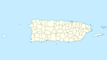
 X64 Location in Puerto Rico | |||||||||||
| Runways | |||||||||||
| |||||||||||
Source: Google Maps[1] | |||||||||||
Google Earth Historical Imagery (12/12/2014) shows an east-west 2,000 feet (610 m) asphalt runway. The (7/14/2015) image shows the runway marked closed. Current imagery (1/1/2018) shows the runway area now used for industrial storage.
See also
 Puerto Rico portal
 Aviation portal
- Transport in Puerto Rico
- List of airports in Puerto Rico
References
- "Patillas Airport". Google Maps. Google. Retrieved 5 June 2018.
External links
На других языках
- [en] Patillas Airport
[es] Aeropuerto de Patillas
El Aeropuerto de Patillas[1] (FAA LID: X64)[2] es un aeropuerto público ubicado a una milla (2 km) al suroeste del distrito central de negocios de Patillas, en Puerto Rico. El Aeropuerto de Patillas cubre un área de 16 acres (6,5 ha). Para el período de 12 meses que finalizó el 15 de julio de 1995 el aeropuerto tuvo 2.300 operaciones de aeronaves, un promedio de 6 por día, el 100% de los cuales eran de la aviación general. Hay 10 aviones basados en este aeropuerto: 7 solo motor y 3 ultraligeros.Текст в блоке "Читать" взят с сайта "Википедия" и доступен по лицензии Creative Commons Attribution-ShareAlike; в отдельных случаях могут действовать дополнительные условия.
Другой контент может иметь иную лицензию. Перед использованием материалов сайта WikiSort.org внимательно изучите правила лицензирования конкретных элементов наполнения сайта.
Другой контент может иметь иную лицензию. Перед использованием материалов сайта WikiSort.org внимательно изучите правила лицензирования конкретных элементов наполнения сайта.
2019-2025
WikiSort.org - проект по пересортировке и дополнению контента Википедии
WikiSort.org - проект по пересортировке и дополнению контента Википедии