avia.wikisort.org - Aerodrome
Pocono Mountains Municipal Airport (IATA: MPO[2], ICAO: KMPO, FAA LID: MPO) is a public airport two miles northwest of Mount Pocono, in Coolbaugh Township, Monroe County, Pennsylvania. It is owned by the Pocono Mountains Municipal Airport Authority.[1] The National Plan of Integrated Airport Systems for 2011–2015 categorized it as a general aviation facility.[3]
Pocono Mountains Municipal Airport | |||||||||||||||
|---|---|---|---|---|---|---|---|---|---|---|---|---|---|---|---|
| |||||||||||||||
| Summary | |||||||||||||||
| Airport type | Public | ||||||||||||||
| Owner | Pocono Mountains Municipal Airport Authority | ||||||||||||||
| Serves | Mount Pocono, Pennsylvania | ||||||||||||||
| Elevation AMSL | 1,915 ft / 584 m | ||||||||||||||
| Coordinates | 41°08′16″N 075°22′48″W | ||||||||||||||
| Website | www.MPOairport.com | ||||||||||||||
| Map | |||||||||||||||
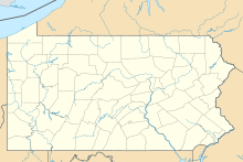
 MPO Location of airport in Pennsylvania | |||||||||||||||
| Runways | |||||||||||||||
| |||||||||||||||
| Statistics (2011) | |||||||||||||||
| |||||||||||||||
Source: Federal Aviation Administration[1] | |||||||||||||||
Facilities
The airport covers 275 acres (111 ha) at an elevation of 1,915 feet (584 m). It has two asphalt runways: 5/23 is 4,000 by 100 feet (1,219 x 30 m) and 13/31 is 5,001 by 75 feet (1,524 x 23 m).[1]
In the year ending August 31, 2011 the airport had 19,850 aircraft operations, average 54 per day: 98.5% general aviation and 1.5% military. 19 aircraft were then based at the airport: 79% single-engine, 10.5% multi-engine, and 10.5% helicopter.[1]
References
- FAA Airport Form 5010 for MPO PDF. Federal Aviation Administration. Effective May 31, 2012.
- "IATA Airport Code Search (MPO: Mt Pocono)". International Air Transport Association. Retrieved December 11, 2012.
- "2011–2015 NPIAS Report, Appendix A" (PDF, 2.03 MB). National Plan of Integrated Airport Systems. Federal Aviation Administration. October 4, 2010.
External links
- Pocono Mountains Municipal Airport
- Pocono Mountains Municipal Airport at Pennsylvania DOT Bureau of Aviation
- Aerial image as of April 1999 from USGS The National Map
- FAA Terminal Procedures for MPO, effective October 6, 2022
- Resources for this airport:
- FAA airport information for MPO
- AirNav airport information for KMPO
- ASN accident history for MPO
- FlightAware airport information and live flight tracker
- NOAA/NWS weather observations: current, past three days
- SkyVector aeronautical chart, Terminal Procedures
Другой контент может иметь иную лицензию. Перед использованием материалов сайта WikiSort.org внимательно изучите правила лицензирования конкретных элементов наполнения сайта.
WikiSort.org - проект по пересортировке и дополнению контента Википедии