avia.wikisort.org - Aerodrome
Royal Air Force Nutts Corner or more simply RAF Nutts Corner is a former Royal Air Force station located 2.7 miles (4.3 km) east of Crumlin, County Antrim, Northern Ireland and 9.2 miles (14.8 km) north west of Belfast.
| RAF Nutts Corner | |||||||||||
|---|---|---|---|---|---|---|---|---|---|---|---|
| Crumlin, County Antrim in Northern Ireland | |||||||||||
 RAF Nutts Corner Shown within Northern Ireland  RAF Nutts Corner RAF Nutts Corner (the United Kingdom) | |||||||||||
| Coordinates | 54°37′52″N 006°09′14″W | ||||||||||
| Type | Royal Air Force Station | ||||||||||
| Site information | |||||||||||
| Owner | Air Ministry Admiralty | ||||||||||
| Operator | Royal Air Force Royal Navy | ||||||||||
| Controlled by | RAF Coastal Command Fleet Air Arm | ||||||||||
| Site history | |||||||||||
| Built | 1939 | ||||||||||
| In use | 1939-1946 | ||||||||||
| Battles/wars | European theatre of World War II | ||||||||||
| Airfield information | |||||||||||
| Elevation | 96 metres (315 ft) AMSL | ||||||||||
| |||||||||||
It was originally a civil airfield, then it became a military airfield and subsequently Northern Ireland's main civil airport until the 1960s.
Civil operations
Civil flights began around 1920 from Aldergrove, what is now Belfast International Airport, approximately 3.3 miles (5.3 km) away from Nutts Corner. The province's first London service began from Nutts Corner in 1934.
Second World War
Civil operations were largely abandoned at both Nutts Corner and RAF Aldergrove during the Second World War when it became an important RAF Coastal Command station and was also used as a transport hub for aircraft arriving from the United States. No. 120 Squadron RAF operated Consolidated Liberator maritime patrol bombers from the station from 1941.
The following units were here at some point:[1]
- 4th Naval Fighter Wing
- No. 44 Squadron RAF
- No. 120 Squadron RAF
- No. 160 Squadron RAF
- No. 220 Squadron RAF
- No. 231 Squadron RAF
- 772 Naval Air Squadron
- 802 Naval Air Squadron
- 803 Naval Air Squadron
- 807 Naval Air Squadron
- 809 Naval Air Squadron
- 879 Naval Air Squadron
- 883 Naval Air Squadron
- 891 Naval Air Squadron
- 1835 Naval Air Squadron
- 1837 Naval Air Squadron
- 1852 Naval Air Squadron
- Units
Post war
In 1946 civil air operations were transferred from HMS Gadwall/Belfast Harbour Airport (now the George Best Belfast City Airport) to RAF Nutts Corner due to the longer runways available at that airfield. Other reasons included the limited space available at Belfast for expansion and the danger associated with obstacles such as the cranes around Belfast harbour. Other sites were studied as possible alternative civil airports including RAF Long Kesh and Lisburn. The advantage of choosing Nutts Corner was the large amount of existing hardstanding which was necessary for civil aircraft movements. The former RAF station then became known as Belfast-Nutts Corner Airport.
By the end of the 1950s the steep approach necessary for aircraft flying to Nutts Corner was deemed unsuitable. This was due to the location of the airport, close to the Belfast mountains and the obstacles located there, particularly transmitters and aerials. Another factor was the fact that of Nutts Corner's three runways, only one was suitable for modern aircraft. Aldergrove's two runways set at 100 degrees (07-25 and 17-35) to each other made operations possible even if conditions (particularly wind) changed dramatically. The decision to restore civil flights to Aldergrove was taken in July 1959. The move was made official in September 1963 and a month later the present terminal was opened.
Current use
A section of the A26 Moira Road, running from Nutts Corner Roundabout for approximately 2 km, is constructed on one of the old runways. The airfield was used from 1984 to 2004 for events such as the Irish Superbike Championships and Rallycross, but it was restricted due to noise complaints from local residents. A small section of the circuit continues to be used by the Northern Ireland Carting Club (NICA) and the Ulster Karting Club. The site is also used for a weekly market and a model aircraft club is on the site.
Accidents and incidents
- On 18 February 1942 a Liberator bomber which was leaving for an Atlantic patrol failed to gain height, struck a radio mast and crashed. Six of the crew survived but four were killed.[5]
- On 21 August 1942 the World War I air ace Harry King Goode was killed on a demonstration flight with a 120 Squadron Consolidated Liberator stationed at the base.
- On 27 March 1951 a Douglas Dakota 3 cargo aircraft operated by Air Transport Charter[6] and en route from Ringway Airport, Manchester, crashed shortly after take-off following failure to gain height. There were four fatalities, two of the three crew on board and two of the three passengers. The subsequent investigation found that the crash resulted from a loss of engine power caused by ice formation in the carburetor intakes attributable to the captain's failure to make use of the heat controls. An extended undercarriage and the presence of snow on the wings may have also been contributory factors.[7]
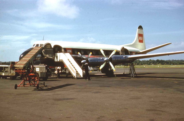
- Nutts Corner was the site of the worst air disaster in Ireland,[8] when on 5 January 1953 a British European Airways (BEA) Vickers Viking crashed after striking landing lights and then a building at the airfield, killing 27 people out of 35 on board.[9]
- On 23 October 1957 a Vickers Viscount of BEA crashed at the airport, killing all seven on board.[10]
See also
References
Citations
- "Nutt's Corner (Belfast)". Airfields of Britain Conservation Trust. Retrieved 7 June 2020.
- Sturtivant, Hamlin & Halley 1997, p. 244.
- Sturtivant, Hamlin & Halley 1997, p. 99.
- Sturtivant, Hamlin & Halley 1997, p. 102.
- "The thoughts of Ulster Aviation Society's Ernie Cromie are about to turn again to the horrific crash of Liberator bomber AM925X at the old Nutt's Corner RAF base 68 years ago with the loss of four lives". Belfast Telegraph. Belfast Telegraph Newspapers Ltd. 23 January 2010.
- "ATDB.aero aerotransport.org AeroTransport Data Bank". www.aerotransport.org.
- Ranter, Harro. "ASN Aircraft accident Douglas C-47A-75-DL Dakota 3 G-AJVZ Manchester-Ringway Airport (MAN)". aviation-safety.net.
- "Nutts Corner air crash: A forgotten tragedy". 3 January 2013 – via www.bbc.co.uk.
- http://aviation-safety.net/database/record.php?id=19530105-0&lang=en Aviation Safety Network
- http://aviation-safety.net/database/record.php?id=19571023-0&lang=en Aviation Safety Network
Bibliography
- Sturtivant, R; Hamlin, J; Halley, J (1997). Royal Air Force flying training and support units. UK: Air-Britain (Historians). ISBN 0-85130-252-1.
External links
- Accident history for Belfast-Nutts Corner Airport at Aviation Safety Network
| Formations and units |
|  | ||||||
|---|---|---|---|---|---|---|---|---|
| Branches and components |
| |||||||
| Reserve forces |
| |||||||
| Associated civil organisations |
| |||||||
| Equipment |
| |||||||
| Personnel |
| |||||||
| Appointments |
| |||||||
| Symbols and uniform |
| |||||||
| ||||||||
Другой контент может иметь иную лицензию. Перед использованием материалов сайта WikiSort.org внимательно изучите правила лицензирования конкретных элементов наполнения сайта.
WikiSort.org - проект по пересортировке и дополнению контента Википедии