avia.wikisort.org - Aerodrome
Royal Air Force Silloth or RAF Silloth is a former Royal Air Force station one mile (1.6 km) north-east of Silloth, Cumbria, England, and 6.7 miles (10.8 km) south-west of Kirkbride, Cumbria. The station was used by RAF Coastal Command.
RAF Silloth | |||||||||||||||||||
|---|---|---|---|---|---|---|---|---|---|---|---|---|---|---|---|---|---|---|---|
| |||||||||||||||||||
| Summary | |||||||||||||||||||
| Airport type | Military | ||||||||||||||||||
| Owner | Ministry of Defence | ||||||||||||||||||
| Operator | Royal Air Force | ||||||||||||||||||
| Location | Silloth | ||||||||||||||||||
| Built | 1939 | ||||||||||||||||||
| In use | 1939-1960 | ||||||||||||||||||
| Elevation AMSL | 23 ft / 7 m | ||||||||||||||||||
| Coordinates | 54°52′10″N 003°21′37″W | ||||||||||||||||||
| Map | |||||||||||||||||||
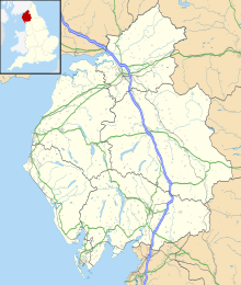 RAF Silloth Location in Cumbria | |||||||||||||||||||
| Runways | |||||||||||||||||||
| |||||||||||||||||||
Operational dates.[1] | |||||||||||||||||||
The airfield is also known as Silloth Airfield/Aerodrome.[2]
Station history

The airfield was originally designed to be used by RAF Maintenance Command but was handed over to Coastal Command in November 1939.[1] It had a satellite at RAF Hornby Hall.
Based units
- No. 1 (Coastal) Operational Training Unit RAF (OTU) using Avro Ansons, Bristol Beauforts and Bothas.[1]
- No. 6 Operational Training Unit RAF with the Vickers Wellington and Anson.[1]
- No. 215 Squadron RAF using the Wellington.[3]
- No. 320 (Netherlands) Squadron RAF using the Avro Anson I.[4]
- No. 22 Maintenance Unit RAF.[1]
- No. 1353 (Target Towing) Flight RAF using the Supermarine Spitfire and the Vultee A-31 Vengeance.[1]
- No. 5 Ferry Pool RAF.[1]
Current use
Many of the buildings still survive, including the hangars, but the runways are in a bad condition.[1]
A farmers' market and Seacote Caravan Park occupy the outer edge of the airport. A number of private homes are found on the north-west side of the former airfield. Enkev, a natural fibre company, has its UK office at the airfield.
See also
- List of former Royal Air Force stations
References
Citations
- "RAF Silloth". Control Towers. Retrieved 26 April 2012.
- "Silloth Airfield". Silloth Airfield.
- Jefford 1988, p. 71.
- Jefford 1988, p. 86.
Bibliography
- Jefford, C G (1988). RAF Squadrons. A comprehensive record of the movement and equipment of all RAF squadrons and their antecedents since 1912. Shrewsbury: Airlife. ISBN 1-85310-053-6.
External links
| Formations and units |
|  | ||||||
|---|---|---|---|---|---|---|---|---|
| Branches and components |
| |||||||
| Reserve forces |
| |||||||
| Associated civil organisations |
| |||||||
| Equipment |
| |||||||
| Personnel |
| |||||||
| Appointments |
| |||||||
| Symbols and uniform |
| |||||||
| ||||||||
Другой контент может иметь иную лицензию. Перед использованием материалов сайта WikiSort.org внимательно изучите правила лицензирования конкретных элементов наполнения сайта.
WikiSort.org - проект по пересортировке и дополнению контента Википедии