avia.wikisort.org - Aerodrome
Sky Harbor Airport (FAA LID: S86) was a privately owned, public use airport located one nautical mile (2 km) east of the central business district of Sultan, a city in Snohomish County, Washington, United States.[1] It was decommissioned in 2018 and replaced with a housing development.[citation needed]
Sky Harbor Airport | |||||||||||
|---|---|---|---|---|---|---|---|---|---|---|---|
| |||||||||||
| Summary | |||||||||||
| Airport type | Public use | ||||||||||
| Owner | Barry A. Hammer | ||||||||||
| Serves | Sultan, Washington | ||||||||||
| Elevation AMSL | 282 ft / 86 m | ||||||||||
| Coordinates | 47°52′14″N 121°47′32″W | ||||||||||
| Map | |||||||||||
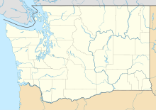 S86 Location of airport in Washington | |||||||||||
| Runways | |||||||||||
| |||||||||||
| Statistics (2012) | |||||||||||
| |||||||||||
Source: Federal Aviation Administration[1] | |||||||||||
Facilities and aircraft
Sky Harbor Airport covered an area of 20 acres (8 ha) at an elevation of 282 feet (86 m) above mean sea level. It had one runway designated 7/25 with a turf surface measuring 1,930 by 100 feet (588 x 30 m).[1]
For the 12-month period ending July 30, 2012, the airport had 600 general aviation aircraft operations, an average of 50 per month. At that time there were three single-engine aircraft based at this airport.[1]
References
- FAA Airport Form 5010 for S86 PDF. Federal Aviation Administration. Effective November 15, 2012.
External links
- Sky Harbor (S86) at WSDOT Airport Directory
- Aerial image as of July 1990 from USGS The National Map
- Resources for this airport:
- FAA airport information for S86
- AirNav airport information for S86
- FlightAware airport information and live flight tracker
- SkyVector aeronautical chart for S86
Текст в блоке "Читать" взят с сайта "Википедия" и доступен по лицензии Creative Commons Attribution-ShareAlike; в отдельных случаях могут действовать дополнительные условия.
Другой контент может иметь иную лицензию. Перед использованием материалов сайта WikiSort.org внимательно изучите правила лицензирования конкретных элементов наполнения сайта.
Другой контент может иметь иную лицензию. Перед использованием материалов сайта WikiSort.org внимательно изучите правила лицензирования конкретных элементов наполнения сайта.
2019-2025
WikiSort.org - проект по пересортировке и дополнению контента Википедии
WikiSort.org - проект по пересортировке и дополнению контента Википедии