avia.wikisort.org - Aerodrome
Taylor Airport (FAA LID: T14) is a privately owned, public use airport located three nautical miles (6 km) northeast of the central business district of Quinlan, a city in Hunt County, Texas, United States.[1][3]
Taylor Airport | |||||||||||
|---|---|---|---|---|---|---|---|---|---|---|---|
| |||||||||||
| Summary | |||||||||||
| Airport type | Public use | ||||||||||
| Owner/Operator | Walt Meziere | ||||||||||
| Serves | Quinlan, Texas | ||||||||||
| Elevation AMSL | 473 ft / 144 m | ||||||||||
| Coordinates | 32°57′09″N 096°05′45″W | ||||||||||
| Map | |||||||||||
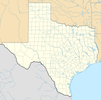 T14 Location of airport in Texas | |||||||||||
| Runways | |||||||||||
| |||||||||||
Facilities
The Taylor Airport resides at an elevation of 473 feet (144 m) above mean sea level. It has one runway designated 18/36 with a turf surface measuring 3,120 by 60 feet (951 m × 18 m).[1][3]
References
- FAA Airport Form 5010 for T14 PDF. Federal Aviation Administration. Effective January 3, 2011.
- "T14 – Taylor M Airport" (PDF). Airport Directory. Texas Department of Transportation. November 6, 2007.
- www.t14airport.com
External links
- Aerial image as of February 1995 from USGS The National Map
- Resources for this airport:
- FAA airport information for T14
- AirNav airport information for T14
- FlightAware airport information and live flight tracker
- SkyVector aeronautical chart for T14
Текст в блоке "Читать" взят с сайта "Википедия" и доступен по лицензии Creative Commons Attribution-ShareAlike; в отдельных случаях могут действовать дополнительные условия.
Другой контент может иметь иную лицензию. Перед использованием материалов сайта WikiSort.org внимательно изучите правила лицензирования конкретных элементов наполнения сайта.
Другой контент может иметь иную лицензию. Перед использованием материалов сайта WikiSort.org внимательно изучите правила лицензирования конкретных элементов наполнения сайта.
2019-2025
WikiSort.org - проект по пересортировке и дополнению контента Википедии
WikiSort.org - проект по пересортировке и дополнению контента Википедии