avia.wikisort.org - Aerodrome
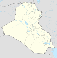
Tikrit East Air Base is a former Iraqi Air Force base in the Saladin Governorate of Iraq. It was captured by Coalition forces during Operation Iraqi Freedom in 2003.
| Tikrit East Air Base | |
|---|---|
| Coordinates | 34°36′37″N 043°46′24″E |

Overview
Tikrit East Air Base was an auxiliary air base for the Iraqi Air Force. It had a 9,700 foot runway, a parking ramp and a few support structures. It attacked by Coalition air forces during Operation Iraqi Freedom with numerous bomb craters visible in the main runway. It was abandoned by the Iraqi Air Force after March 2003.
Current aerial imagery shows that the operational structures around the airfield appear to have been demolished and removed. Today the concrete runway and series of taxiways remain exposed and deteriorating to the elements, being reclaimed by the desert.
See also
- Tikrit East Airport
References
![]() This article incorporates public domain material from the Air Force Historical Research Agency website http://www.afhra.af.mil/.
This article incorporates public domain material from the Air Force Historical Research Agency website http://www.afhra.af.mil/.
На других языках
[de] Tikrit East Airport
Der Tikrit East Airport (ICAO: ORTK, FAA: IQ-0052) ist ein Militärflugplatz 9 km östlich von Tikrit (Irak). Er liegt östlich des Tigris.[1] Er ist neben Camp Speicher und Tikrit South Airport einer von drei Flughäfen im Umfeld der Stadt. Er verfügt über zwei Start- und Landebahnen sowie Rollbahnen und einige Gebäude. Er ist zurzeit verlassen.- [en] Tikrit East Air Base
Другой контент может иметь иную лицензию. Перед использованием материалов сайта WikiSort.org внимательно изучите правила лицензирования конкретных элементов наполнения сайта.
WikiSort.org - проект по пересортировке и дополнению контента Википедии