avia.wikisort.org - Aerodrome
Warrenton–Fauquier Airport (ICAO: KHWY, FAA LID: HWY, formerly W66) is a public airport 14 miles southeast of Warrenton, a town in Fauquier County, Virginia.[1]
Warrenton–Fauquier Airport | |||||||||||
|---|---|---|---|---|---|---|---|---|---|---|---|
 | |||||||||||
| Summary | |||||||||||
| Airport type | Public | ||||||||||
| Owner | Fauquier County | ||||||||||
| Serves | Warrenton, Virginia | ||||||||||
| Elevation AMSL | 336 ft / 102 m | ||||||||||
| Coordinates | 38°35′11″N 077°42′38″W | ||||||||||
| Map | |||||||||||
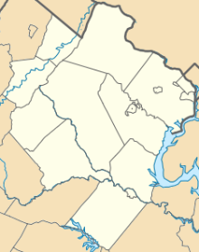 HWY 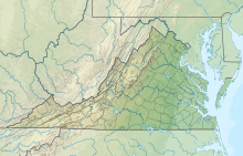 HWY  HWY | |||||||||||
| Runways | |||||||||||
| |||||||||||
| Statistics (2007) | |||||||||||
| |||||||||||
Source: Federal Aviation Administration[1] | |||||||||||
Most U.S. airports use the same three-letter location identifier for the FAA and IATA, but this airport is HWY to the FAA and has no IATA code.[2]

Facilities
Warrenton–Fauquier Airport covers 407 acres (165 ha) at an elevation of 336 feet (102 m). Its single runway, 15/33, is 5,000 by 100 feet (1,524 m × 30 m) asphalt.[1]
In the year ending June 29, 2007 the airport had 42,184 aircraft operations, average 115 per day: 98% general aviation, 1% air taxi and <1% military. 119 aircraft were then based at this airport: 84% single-engine (100), 13% multi-engine, 3% ultralight and 1% helicopter.[1]
See also
 Virginia portal
- List of airports in Virginia
References
- FAA Airport Form 5010 for HWY PDF, effective 2008-04-10
- Great Circle Mapper: KHWY - Warrenton, Virginia
External links
Wikimedia Commons has media related to Warrenton–Fauquier Airport.
- Resources for this airport:
- FAA airport information for HWY
- AirNav airport information for KHWY
- FlightAware airport information and live flight tracker
- NOAA/NWS weather observations: current, past three days
- SkyVector aeronautical chart, Terminal Procedures
- FAA Terminal Procedures for HWY, effective June 16, 2022
Текст в блоке "Читать" взят с сайта "Википедия" и доступен по лицензии Creative Commons Attribution-ShareAlike; в отдельных случаях могут действовать дополнительные условия.
Другой контент может иметь иную лицензию. Перед использованием материалов сайта WikiSort.org внимательно изучите правила лицензирования конкретных элементов наполнения сайта.
Другой контент может иметь иную лицензию. Перед использованием материалов сайта WikiSort.org внимательно изучите правила лицензирования конкретных элементов наполнения сайта.
2019-2025
WikiSort.org - проект по пересортировке и дополнению контента Википедии
WikiSort.org - проект по пересортировке и дополнению контента Википедии