avia.wikisort.org - Aerodrome
Winchester Regional Airport (IATA: WGO, ICAO: KOKV, FAA LID: OKV) is three miles southeast of Winchester, in Frederick County, Virginia.[1] It was recognized by the state as a licensed commercial airport in 1937 and was Winchester Municipal Airport until 1987.[2]
Winchester Regional Airport | |||||||||||
|---|---|---|---|---|---|---|---|---|---|---|---|
| |||||||||||
| Summary | |||||||||||
| Airport type | Public | ||||||||||
| Owner | Winchester Regional Airport Authority | ||||||||||
| Serves | Winchester, Virginia | ||||||||||
| Elevation AMSL | 726 ft / 221 m | ||||||||||
| Coordinates | 39°08′38″N 078°08′40″W | ||||||||||
| Website | flyokv.com | ||||||||||
| Map | |||||||||||
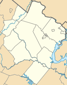 KOKV  KOKV | |||||||||||
| Runways | |||||||||||
| |||||||||||
| Statistics (June 30, 2015 - June 30, 2016) | |||||||||||
| |||||||||||
Source: Federal Aviation Administration[1] | |||||||||||
Most U.S. airports use the same three-letter location identifier for the FAA and IATA, but this airport is OKV to the FAA and WGO to the IATA[3] (which assigned OKV to Okao Airport in Papua New Guinea[4]).
Facilities
Winchester Regional Airport covers 375 acres (152 ha) at an elevation of 726 feet (221 m). Its one runway, 14/32, is 5,500 by 100 feet (1,676 x 30 m);[1] the runway supports instrument landing approaches, with the localizer on the northwest side of the airport.[5]
For the 12 month period ending June 30, 2016, the airport had 44,115 aircraft operations, averaging 121 per day. Of these, 96% (42,250) were general aviation, and 4% (1,865) were air taxi. 99 aircraft were based at the airport at the time: 82 single-engine, 14 multi-engine, 1 jet, 1 helicopter and 1 ultralight.[1]
References
- FAA Airport Form 5010 for OKV PDF, effective 2009-05-07.
- "From a grass runway to a busy modern enterprise" (PDF). The Winchester Star. 2007-12-27.
- Great Circle Mapper: WGO / KOKV - Winchester, Virginia (Winchester Regional Airport)
- Aviation Safety Network: OKV - Okao Airport, Papua New Guinea
- "FAA diagram of the instrument approach".
External links
- FAA Terminal Procedures for OKV, effective June 16, 2022
- Resources for this airport:
- FAA airport information for OKV
- AirNav airport information for KOKV
- ASN accident history for WGO
- FlightAware airport information and live flight tracker
- NOAA/NWS weather observations: current, past three days
- SkyVector aeronautical chart, Terminal Procedures
На других языках
[de] Winchester Regional Airport
Winchester Regional Airport (IATA: WGO, ICAO: KOKV, FAA LID: OKV) ist ein öffentlicher Flughafen im Besitz der Winchester Regional Airport Authority. Er liegt etwa 6 km südöstlich des Central Business District von Winchester, einer Independent City in Virginia in den Vereinigten Staaten, die vollständig vom Frederick County umgeben ist.[1] Der Flughafen wurde 1937 erstmals für den kommerziellen Luftverkehr lizenziert und wurde bis 1987 als Winchester Municipal Airport bezeichnet.[2][3]- [en] Winchester Regional Airport
Другой контент может иметь иную лицензию. Перед использованием материалов сайта WikiSort.org внимательно изучите правила лицензирования конкретных элементов наполнения сайта.
WikiSort.org - проект по пересортировке и дополнению контента Википедии