avia.wikisort.org - Aerodrome
Yale Airport (FAA LID: D20) is a public-use airport located one nautical mile (1.85 km) southeast of the central business district of Yale, a city in St. Clair County, Michigan, United States.[1]
Yale Airport | |||||||||||
|---|---|---|---|---|---|---|---|---|---|---|---|
| |||||||||||
| Summary | |||||||||||
| Airport type | Public | ||||||||||
| Owner | Jerry L. Norris | ||||||||||
| Serves | Yale, Michigan | ||||||||||
| Elevation AMSL | 814 ft / 248 m | ||||||||||
| Coordinates | 43°06′45″N 082°47′15″W | ||||||||||
| Map | |||||||||||
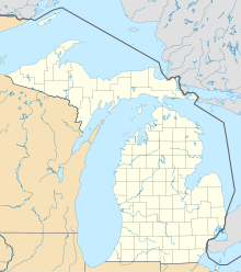 Yale Airport | |||||||||||
| Runways | |||||||||||
| |||||||||||
| Statistics (2009) | |||||||||||
| |||||||||||
Source: Federal Aviation Administration[1] | |||||||||||
Facilities and aircraft
Yale Airport covers an area of 15 acres (6.1 ha) at an elevation of 814 feet (248 m) above mean sea level. It has one runway designated 9/27 with a turf surface measuring 2,300 by 110 feet (701 x 34 m). For the 12-month period ending December 31, 2009, the airport had 200 general aviation aircraft operations, an average of 16 per month.[1]
References
- FAA Airport Form 5010 for D20 PDF. Federal Aviation Administration. effective 29 July 2010.
External links
- Yale (D20) airport diagram from Michigan DOT
- Aerial image as of 28 March 1999 from USGS The National Map
- Resources for this airport:
- FAA airport information for D20
- AirNav airport information for D20
- FlightAware airport information and live flight tracker
- SkyVector aeronautical chart for D20
This article about a Michigan airport is a stub. You can help Wikipedia by expanding it. |
Текст в блоке "Читать" взят с сайта "Википедия" и доступен по лицензии Creative Commons Attribution-ShareAlike; в отдельных случаях могут действовать дополнительные условия.
Другой контент может иметь иную лицензию. Перед использованием материалов сайта WikiSort.org внимательно изучите правила лицензирования конкретных элементов наполнения сайта.
Другой контент может иметь иную лицензию. Перед использованием материалов сайта WikiSort.org внимательно изучите правила лицензирования конкретных элементов наполнения сайта.
2019-2025
WikiSort.org - проект по пересортировке и дополнению контента Википедии
WikiSort.org - проект по пересортировке и дополнению контента Википедии