avia.wikisort.org - Aérodrome
L'aéroport de Libenge (code IATA : LIE • code OACI : FZFA) est l'aéroport de la ville de Libenge sur la rivière Ubangi, dans la province de Sud-Ubangi en République démocratique du Congo. La localité d'Ubangi est à la frontière avec la République Centrafricaine.
Cet article est une ébauche concernant un aéroport et la république démocratique du Congo.
Vous pouvez partager vos connaissances en l’améliorant (comment ?) selon les recommandations des projets correspondants.
| Aéroport de Libenge | ||||||||||
 Aéroport de Libenge | ||||||||||
| Localisation | ||||||||||
|---|---|---|---|---|---|---|---|---|---|---|
| Pays | ||||||||||
| Coordonnées | 3° 37′ 45″ nord, 18° 38′ 15″ est | |||||||||
| Altitude | 343 m (1 125 ft) | |||||||||
| Informations aéronautiques | ||||||||||
| Code IATA | LIE | |||||||||
| Code OACI | FZFA | |||||||||
| Type d'aéroport | Public | |||||||||
|
||||||||||
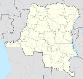
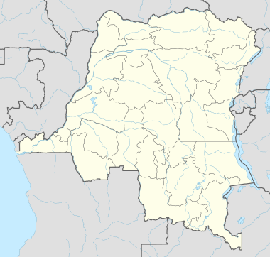
| Géolocalisation sur la carte : République démocratique du Congo
| ||||||||||
| modifier |
||||||||||
Histoire
Cette section est vide, insuffisamment détaillée ou incomplète. Votre aide est la bienvenue ! Comment faire ?
Situation
Basango Mboliasa Bunia Ilebo Kananga Kikwit Kindu Kinshasa-Ndjili Kolwezi Lodja Nioki Tshikapa Tshumbe |
Compagnies et destinations
Notes et références
 Portail de l’aéronautique
  République démocratique du Congo
На других языках
[en] Libenge Airport
Libenge Airport (IATA: LIE, ICAO: FZFA) is an airport serving the Ubangi River town of Libenge in the Sud-Ubangi Province of the Democratic Republic of the Congo. The Ubangi is locally the border with the Central African Republic.- [fr] Aéroport de Libenge
Текст в блоке "Читать" взят с сайта "Википедия" и доступен по лицензии Creative Commons Attribution-ShareAlike; в отдельных случаях могут действовать дополнительные условия.
Другой контент может иметь иную лицензию. Перед использованием материалов сайта WikiSort.org внимательно изучите правила лицензирования конкретных элементов наполнения сайта.
Другой контент может иметь иную лицензию. Перед использованием материалов сайта WikiSort.org внимательно изучите правила лицензирования конкретных элементов наполнения сайта.
2019-2025
WikiSort.org - проект по пересортировке и дополнению контента Википедии
WikiSort.org - проект по пересортировке и дополнению контента Википедии