avia.wikisort.org - Aerodrome
Abbeyfeale Aerodrome is a recreational airfield serving Abbeyfeale, a town in County Limerick in Ireland. It is 3 kilometres (2 mi) west-northwest of Abbeyfeale.
Abbeyfeale Aerodrome | |||||||||||
|---|---|---|---|---|---|---|---|---|---|---|---|
| |||||||||||
| Summary | |||||||||||
| Airport type | Private | ||||||||||
| Serves | Abbeyfeale, Republic of Ireland | ||||||||||
| Elevation AMSL | 300 ft / 91 m | ||||||||||
| Coordinates | 52°23′45″N 9°20′25″W | ||||||||||
| Map | |||||||||||
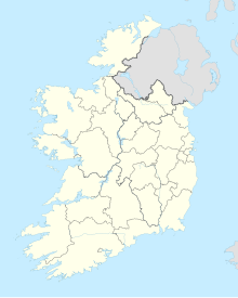 Abbeyfeale Airfield Location in Ireland | |||||||||||
| Runways | |||||||||||
| |||||||||||
The runway has a 30 metres (98 ft) displaced threshold on each end.
Abbeyfeale is not a licensed airfield.[3]
See also
 Ireland portal
 Aviation portal
- Transport in the Republic of Ireland
- List of airports in the Republic of Ireland
References
- "Abbeyfeale Airfield". Our Airports. Retrieved 19 March 2019.
- "Abbeyfeale Aerodrome". Google Maps. Google. Retrieved 19 March 2019.
- IAIP list of licensed airfields
External links
Airports in Ireland | ||||||
|---|---|---|---|---|---|---|
| Northern Ireland |
| |||||
| Republic of Ireland (Statistics) |
| |||||
Smaller airports handling domestic, charter or private services only. | ||||||
This Ireland-related article is a stub. You can help Wikipedia by expanding it. |
Текст в блоке "Читать" взят с сайта "Википедия" и доступен по лицензии Creative Commons Attribution-ShareAlike; в отдельных случаях могут действовать дополнительные условия.
Другой контент может иметь иную лицензию. Перед использованием материалов сайта WikiSort.org внимательно изучите правила лицензирования конкретных элементов наполнения сайта.
Другой контент может иметь иную лицензию. Перед использованием материалов сайта WikiSort.org внимательно изучите правила лицензирования конкретных элементов наполнения сайта.
2019-2025
WikiSort.org - проект по пересортировке и дополнению контента Википедии
WikiSort.org - проект по пересортировке и дополнению контента Википедии