avia.wikisort.org - Aerodrome
Arthur N. Neu Airport (IATA: CIN, ICAO: KCIN, FAA LID: CIN) is a public airport five miles southeast of Carroll, in Carroll County, Iowa.[1] Also known as Arthur N. Neu Municipal Airport, it was established at its current location in the 1940s.[2]
Arthur N. Neu Airport | |||||||||||||||
|---|---|---|---|---|---|---|---|---|---|---|---|---|---|---|---|
| |||||||||||||||
| Summary | |||||||||||||||
| Airport type | Public | ||||||||||||||
| Owner | City of Carroll | ||||||||||||||
| Serves | Carroll, Iowa | ||||||||||||||
| Elevation AMSL | 1,204 ft / 367 m | ||||||||||||||
| Coordinates | 42°02′46″N 094°47′20″W | ||||||||||||||
| Website | cityofcarroll.com/... | ||||||||||||||
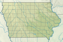
| Map | |||||||||||||||
 CIN  CIN | |||||||||||||||
| Runways | |||||||||||||||
| |||||||||||||||
| Statistics | |||||||||||||||
| |||||||||||||||
Source: Federal Aviation Administration[1] | |||||||||||||||
Facilities
Arthur N. Neu Airport covers 300 acres (120 ha) at an elevation of 1,204 feet (367 m). It has two lighted runways: Runway 13/31 is 5,506 by 100 feet (1,676 x 30 m) with instrument approach and non-directional beacon. Runway 3/21 is 3,301 by 60 feet (1,006 x 18 m).[1][2]
In the year ending August 20, 2017, the airport had 7,700 aircraft operations, average 21 per day: 91% general aviation, 8% air taxi and <1% military. In January 2017, 16 aircraft were based at the airport: 11 single-engine, 4 multi-engine and 1 ultralight.[1] The airport has hangar space for 24 aircraft.[2]
References
- FAA Airport Form 5010 for CIN PDF, effective Jan 5, 2017.
- Arthur N. Neu Municipal Airport Archived May 24, 2009, at the Wayback Machine page at City of Carroll website
External links
- Carroll Municipal - Arthur N. Neu (CIN) at Iowa DOT Airport Directory
- FAA Terminal Procedures for CIN, effective May 19, 2022
- Resources for this airport:
- FAA airport information for CIN
- AirNav airport information for KCIN
- ASN accident history for CIN
- FlightAware airport information and live flight tracker
- NOAA/NWS weather observations: current, past three days
- SkyVector aeronautical chart, Terminal Procedures
Другой контент может иметь иную лицензию. Перед использованием материалов сайта WikiSort.org внимательно изучите правила лицензирования конкретных элементов наполнения сайта.
WikiSort.org - проект по пересортировке и дополнению контента Википедии