avia.wikisort.org - Aerodrome
Ashland Municipal Airport (Sumner Parker Field) (IATA: AHM[2], FAA LID: S03) is two miles east of Ashland, in Jackson County, Oregon.[1] The National Plan of Integrated Airport Systems for 2011 through 2015 categorized it as a general aviation facility.[3]
Ashland Municipal Airport Sumner Parker Field | |||||||||||
|---|---|---|---|---|---|---|---|---|---|---|---|
 orthophoto of Ashland Municipal Airport | |||||||||||
| |||||||||||
| Summary | |||||||||||
| Airport type | Public | ||||||||||
| Owner | City of Ashland | ||||||||||
| Serves | Ashland, Oregon | ||||||||||
| Elevation AMSL | 1,885 ft / 575 m | ||||||||||
| Coordinates | 42°11′25″N 122°39′38″W | ||||||||||
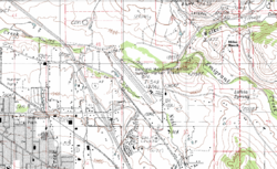
| Map | |||||||||||
 S03 | |||||||||||
| Runways | |||||||||||
| |||||||||||
| Statistics (2012) | |||||||||||
| |||||||||||
Source: Federal Aviation Administration[1] | |||||||||||
Facilities

The airport covers 94 acres (38 ha) at an elevation of 1,885 feet (575 m). Its one runway, 12/30, is 3,603 by 75 feet (1,098 x 23 m).[1]
In the year ending April 10, 2012 the airport had 26,050 aircraft operations, average 71 per day: 94% general aviation, 6% air taxi, and <1% military. 62 aircraft were then based at the airport: 79% single-engine, 8% helicopter, 6.5% multi-engine, and 6.5% ultralight.[1]
References
- FAA Airport Form 5010 for S03 PDF. Federal Aviation Administration. Effective May 31, 2012.
- "Airline and Airport Code Search (AHM: Sumner Parker Field, Ashland)". International Air Transport Association (IATA). Retrieved September 27, 2012.
- "2011–2015 NPIAS Report, Appendix A" (PDF). National Plan of Integrated Airport Systems. Federal Aviation Administration. October 4, 2010. Archived from the original (PDF, 2.03 MB) on 2012-09-27.
External links
- Aerial image as of August 1994 from USGS The National Map
- Resources for this airport:
- FAA airport information for S03
- AirNav airport information for S03
- FlightAware airport information and live flight tracker
- SkyVector aeronautical chart for S03
Текст в блоке "Читать" взят с сайта "Википедия" и доступен по лицензии Creative Commons Attribution-ShareAlike; в отдельных случаях могут действовать дополнительные условия.
Другой контент может иметь иную лицензию. Перед использованием материалов сайта WikiSort.org внимательно изучите правила лицензирования конкретных элементов наполнения сайта.
Другой контент может иметь иную лицензию. Перед использованием материалов сайта WikiSort.org внимательно изучите правила лицензирования конкретных элементов наполнения сайта.
2019-2025
WikiSort.org - проект по пересортировке и дополнению контента Википедии
WikiSort.org - проект по пересортировке и дополнению контента Википедии