avia.wikisort.org - Aerodrome
Charaña Airport Spanish: Aeropuerto Charaña, (ICAO: SLCN) is an extremely high elevation airstrip serving Charaña, a town in the altiplano of the La Paz Department of Bolivia. The airport is east of the town and 3 kilometres (1.9 mi) east of the border with Chile.
Charaña Airport | |||||||||||
|---|---|---|---|---|---|---|---|---|---|---|---|
| |||||||||||
| Summary | |||||||||||
| Airport type | Public | ||||||||||
| Serves | Charaña | ||||||||||
| Elevation AMSL | 13,310 ft / 4,057 m | ||||||||||
| Coordinates | 17°35′40″S 69°26′00″W | ||||||||||
| Map | |||||||||||
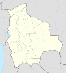  SLCN Location of Charaña Airport in Bolivia | |||||||||||
| Runways | |||||||||||
| |||||||||||
The Charana non-directional beacon (Ident: CHA) is located on the field.[4]
See also
 Bolivia portal
 Aviation portal
- Transport in Bolivia
- List of airports in Bolivia


References
- Airport record for Charaña Airport at Landings.com. Retrieved 2013-09-02
- Airport information for Charaña Airport at Great Circle Mapper.
- Google Maps - Charaña
- Charana NDB
External links
- OpenStreetMap - Charaña
- OurAirports - Charaña
- SkyVector - Charaña
- Fallingrain - Charaña Airport
- Accident history for Charaña Airport at Aviation Safety Network
 | This Bolivia-related article is a stub. You can help Wikipedia by expanding it. |
 | This article about an airport in Bolivia is a stub. You can help Wikipedia by expanding it. |
Текст в блоке "Читать" взят с сайта "Википедия" и доступен по лицензии Creative Commons Attribution-ShareAlike; в отдельных случаях могут действовать дополнительные условия.
Другой контент может иметь иную лицензию. Перед использованием материалов сайта WikiSort.org внимательно изучите правила лицензирования конкретных элементов наполнения сайта.
Другой контент может иметь иную лицензию. Перед использованием материалов сайта WikiSort.org внимательно изучите правила лицензирования конкретных элементов наполнения сайта.
2019-2026
WikiSort.org - проект по пересортировке и дополнению контента Википедии
WikiSort.org - проект по пересортировке и дополнению контента Википедии