avia.wikisort.org - Aerodrome
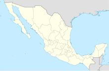
The Chilpancingo National Airport is an airport located in the city of Chilpancingo, Guerrero, México. The airport serves General Aviation for the Capital of Guerrero, as there are currently no commercial passenger or cargo air carriers operating at the airport. The ICAO airport code is MMCH, but it does not have an IATA code yet.
Chilpancingo National Airport Aeropuerto Nacional de Chilpancingo | |||||||||||
|---|---|---|---|---|---|---|---|---|---|---|---|
| |||||||||||
| Summary | |||||||||||
| Airport type | Public | ||||||||||
| Serves | Chilpancingo | ||||||||||
| Elevation AMSL | 4,199 ft / 1,279 m | ||||||||||
| Coordinates | 17°34′26″N 99°30′52″W | ||||||||||
| Map | |||||||||||
 Chilpancingo National Airport | |||||||||||
| Runways | |||||||||||
| |||||||||||
| Statistics (2019) | |||||||||||
| |||||||||||
Source: Agencia Federal de Aviación Civil | |||||||||||
This airport only has a single runway, located on the northern side of the city.
External links
На других языках
- [en] Chilpancingo National Airport
[es] Aeropuerto Nacional de Chilpancingo
El Aeropuerto Nacional de Chilpancingo o Aeródromo Doctor Alfonso G. Alarcón (Código OACI: MMCH - Código DGAC: CHG), es un aeródromo situado en la ciudad de Chilpancingo, Guerrero, México. El aeropuerto es utilizado principalmente por la aviación general, ya que actualmente no existen compañías aéreas nacionales que operen en el aeropuerto.Текст в блоке "Читать" взят с сайта "Википедия" и доступен по лицензии Creative Commons Attribution-ShareAlike; в отдельных случаях могут действовать дополнительные условия.
Другой контент может иметь иную лицензию. Перед использованием материалов сайта WikiSort.org внимательно изучите правила лицензирования конкретных элементов наполнения сайта.
Другой контент может иметь иную лицензию. Перед использованием материалов сайта WikiSort.org внимательно изучите правила лицензирования конкретных элементов наполнения сайта.
2019-2025
WikiSort.org - проект по пересортировке и дополнению контента Википедии
WikiSort.org - проект по пересортировке и дополнению контента Википедии