avia.wikisort.org - Aerodrome
Eastham Airport was an airfield operational in the mid-20th century. The airfield was described as being located in a small field off Herring Brook Road in Eastham, Massachusetts.[1][2]
Eastham Airport | |
|---|---|
| |
| Summary | |
| Operator | Private |
| Location | Eastham, Massachusetts |
| Built | Unknown |
| In use | Around 1946 |
| Occupants | Private |
| Elevation AMSL | 35 ft / 11 m |
| Coordinates | 41°51′3.15″N 69°59′36.04″W |
| Map | |
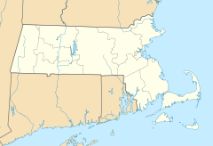 Eastham Airport (Massachusetts)  Eastham Airport (the United States) | |
References
- "Obituaries". Cape Cod Times. 13 December 2001. Archived from the original on 24 June 2013. Retrieved 22 June 2013.
- "Abandoned & Little-Known Airfields: Southeastern Massachusetts". Abandoned & Little-Known Airfields. 30 October 2014. Retrieved 18 April 2016.
Текст в блоке "Читать" взят с сайта "Википедия" и доступен по лицензии Creative Commons Attribution-ShareAlike; в отдельных случаях могут действовать дополнительные условия.
Другой контент может иметь иную лицензию. Перед использованием материалов сайта WikiSort.org внимательно изучите правила лицензирования конкретных элементов наполнения сайта.
Другой контент может иметь иную лицензию. Перед использованием материалов сайта WikiSort.org внимательно изучите правила лицензирования конкретных элементов наполнения сайта.
2019-2026
WikiSort.org - проект по пересортировке и дополнению контента Википедии
WikiSort.org - проект по пересортировке и дополнению контента Википедии