avia.wikisort.org - Aerodrome
El Jaguey Airport (ICAO: MSET) is an airport serving El Jaguey, a coastal town in the La Unión Department of El Salvador.
El Jaguey Airport | |||||||||||
|---|---|---|---|---|---|---|---|---|---|---|---|
| |||||||||||
| Summary | |||||||||||
| Airport type | Private | ||||||||||
| Serves | El Jaguey, El Salvador | ||||||||||
| Elevation AMSL | 10 ft / 3 m | ||||||||||
| Coordinates | 13°09′45″N 087°54′17″W | ||||||||||
| Map | |||||||||||
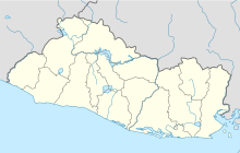 MSET Location in El Salvador | |||||||||||
| Runways | |||||||||||
| |||||||||||
The runway is crossways on a point (Punta de Amapala) at the entrance to the Gulf of Fonseca, and approaches to either end are over the water.
See also
 El Salvador portal
 Aviation portal
- Transport in El Salvador
- List of airports in El Salvador
References
- "Airport information for El Jaguey Airport". World Aero Data. Archived from the original on 2019-03-05.
{{cite web}}: CS1 maint: unfit URL (link) Data current as of October 2006. - Airport information for El Jaguey Airport at Great Circle Mapper.
- "El Tamarindo Airport". Google Maps. Google. Retrieved 7 August 2018.
External links
- OpenStreetMap - El Tamarindo
- OurAirports - El Tamarindo Airport
- Accident history for Canoguero-El Tamarindo Airport at Aviation Safety Network
This article about a Central American airport is a stub. You can help Wikipedia by expanding it. |
This El Salvador location article is a stub. You can help Wikipedia by expanding it. |
На других языках
[de] Aeropuerto de El Tamarindo
Der Aeropuerto de El Tamarindo ist ein Flugplatz im Departamento La Unión am Golf von Fonseca in El Salvador.- [en] El Tamarindo Airport
[es] Aeródromo de El Tamarindo
El aeródromo de El Tamarindo (OACI: MSET), también conocido como el aeródromo de El Jagüey, es un aeródromo de aviación general que sirve al pueblo costero de El Tamarindo en el golfo de Fonseca en el departamento de La Unión de El Salvador.[1][2][3]Текст в блоке "Читать" взят с сайта "Википедия" и доступен по лицензии Creative Commons Attribution-ShareAlike; в отдельных случаях могут действовать дополнительные условия.
Другой контент может иметь иную лицензию. Перед использованием материалов сайта WikiSort.org внимательно изучите правила лицензирования конкретных элементов наполнения сайта.
Другой контент может иметь иную лицензию. Перед использованием материалов сайта WikiSort.org внимательно изучите правила лицензирования конкретных элементов наполнения сайта.
2019-2025
WikiSort.org - проект по пересортировке и дополнению контента Википедии
WikiSort.org - проект по пересортировке и дополнению контента Википедии