avia.wikisort.org - Aerodrome
Hancock County–Bar Harbor Airport (IATA: BHB, ICAO: KBHB, FAA LID: BHB) is a county-owned, public-use airport located in Trenton, Maine, eight nautical miles (9 mi, 15 km) northwest of the central business district of Bar Harbor, a city in Hancock County, Maine, United States.[1] It serves the residents of Hancock County with commercial and charter aviation services. During the summer months, the airport becomes one of Maine's busiest, with significant private jet operations bringing visitors to the numerous summer colonies in the county, which includes Mount Desert Island. Scheduled passenger airline service is subsidized by the Essential Air Service program.[2]
Hancock County–Bar Harbor Airport | |||||||||||||||
|---|---|---|---|---|---|---|---|---|---|---|---|---|---|---|---|
| |||||||||||||||
| Summary | |||||||||||||||
| Airport type | Public | ||||||||||||||
| Owner | Hancock County, Maine | ||||||||||||||
| Serves | Hancock County | ||||||||||||||
| Location | Trenton, Maine | ||||||||||||||
| Elevation AMSL | 83 ft / 25 m | ||||||||||||||
| Coordinates | 44°26′59″N 068°21′42″W | ||||||||||||||
| Website | www.BHBairport.com | ||||||||||||||
| Map | |||||||||||||||
 BHB Location of airport in Maine  BHB BHB (the United States) | |||||||||||||||
| Runways | |||||||||||||||
| |||||||||||||||
| Statistics | |||||||||||||||
| |||||||||||||||
Source: Federal Aviation Administration[1] | |||||||||||||||
As per Federal Aviation Administration records, the airport had 10,562 passenger boardings (enplanements) in calendar year 2008,[3] 10,100 enplanements in 2009, and 11,109 in 2010.[4] It is included in the Federal Aviation Administration (FAA) National Plan of Integrated Airport Systems for 2017–2021, in which it is categorized as a non-primary commercial service facility.[5]
History
The airport operated as Bar Harbor Naval Auxiliary Air Facility (NAAF) supporting operations of Naval Air Station Brunswick from September 1, 1943 until November 15, 1945.[6]
In July 2010, sitting United States president Barack Obama landed at the airport, in a smaller version of Air Force One, for a vacation with his family.[7]
Facilities and aircraft
Hancock County–Bar Harbor Airport covers an area of 468 acres (189 ha) at an elevation of 83 feet (25 m) above mean sea level. It has two asphalt paved runways: 4/22 is 5,200 by 100 feet (1,585 x 30 m) and 17/35 is 3,253 by 75 feet (992 x 23 m).[1] The airport is an uncontrolled airport that has no control tower.[8]
For the 12-month period ending September 30, 2016, the airport had 21,250 aircraft operations, an average of 58 per day: 84% general aviation, 8% scheduled commercial, 7% air taxi, and <1% military. In September 2017, there were 33 aircraft based at this airport: 32 single-engine and 1 glider.[1]
Airlines and destinations
This section does not cite any sources. (January 2022) |
| Airlines | Destinations |
|---|---|
| Cape Air | Boston |
Cape Air operates Cessna 402 twin prop aircraft with code sharing agreements with American Airlines, JetBlue Airways and United Airlines. Previously, the airport was additionally served by Silver Airways Saab 340 and PenAir during the summer months.
Statistics
Carrier shares
| Carrier | Passengers (arriving and departing) |
|---|---|
| Cape Air | 4,520(70.89%) |
| Silver Airways | 1,250(29.11%) |
Top destinations
| Rank | Airport | Passengers | Carriers |
|---|---|---|---|
| 1 | Boston, Massachusetts | 3,230 | Cape Air |
Images
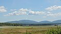 Runway
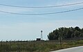 Tower
Tower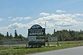 Sign
Sign


References
- FAA Airport Form 5010 for BHB PDF. Federal Aviation Administration. effective September 14, 2017.
- "Order 2012-3-2". U.S. Department of Transportation. March 2, 2012.
- "Enplanements for CY 2008" (PDF, 1.0 MB). faa.gov. Federal Aviation Administration. December 18, 2009.
- "Enplanements for CY 2010" (PDF, 189 KB). faa.gov. Federal Aviation Administration. October 4, 2011.
- "List of NPIAS Airports" (PDF). FAA.gov. Federal Aviation Administration. 21 October 2016. Retrieved 13 May 2017.
- "Patrol Squadron Shore Establishments" (PDF). United States Navy. Retrieved March 7, 2012.
- "Obamas spend vacation playing in Maine’s Acadia National Park" – Denver Post, July 16, 2010
- "KBHB - Hancock County-Bar Harbor Airport". AirNav. Retrieved 2018-05-10.
- "RITA BTS Transtats - BHB". www.transtats.bts.gov.
Other sources
- Essential Air Service documents (Docket OST-2011-0185) from the U.S. Department of Transportation:
- Order 2011-11-26 (November 22, 2011): prohibiting Colgan Air, Inc., operating as US Airways Express, from terminating its subsidized service at Bar Harbor and Presque Isle/Houlton, Maine (Presque Isle), and Plattsburgh, New York, and requesting proposals from airlines interested in providing replacement essential air service (EAS) at any or all of the communities, with or without subsidy.
- Order 2012-3-2 (March 2, 2012): making Essential Air Service (EAS) air carrier selections at Bar Harbor and Presque Isle, Maine, and Plattsburgh, New York. At Bar Harbor, Hyannis Air Service Inc., operating as Cape Air, and Peninsula Airways, Inc. (PenAir) will jointly provide EAS for a four-year term beginning when either carrier begins providing full EAS. PenAir will operate only the peak summer months from Memorial Day through Labor Day, and will operate two daily nonstop round trips to Boston using 34-seat Saab 340 aircraft subsidy free. Cape Air will operate on a year-round basis, providing one daily round trip (seven a week) from Memorial Day through Labor Day, and three daily round trips (21 a week) from September through May using 9-seat Cessna 402 aircraft for an annual subsidy rate of $1,631,223.
External links
- Hancock County-Bar Harbor Airport, official site
- Aerial image from USGS The National Map
- FAA Terminal Procedures for BHB, effective July 14, 2022
- Resources for this airport:
- FAA airport information for BHB
- AirNav airport information for KBHB
- ASN accident history for BHB
- FlightAware airport information and live flight tracker
- NOAA/NWS weather observations: current, past three days
- SkyVector aeronautical chart, Terminal Procedures
Другой контент может иметь иную лицензию. Перед использованием материалов сайта WikiSort.org внимательно изучите правила лицензирования конкретных элементов наполнения сайта.
WikiSort.org - проект по пересортировке и дополнению контента Википедии