avia.wikisort.org - Aerodrome
Maridi Airport is an airport serving Maridi in South Sudan.
Maridi Airport | |||||||||||
|---|---|---|---|---|---|---|---|---|---|---|---|
| |||||||||||
| Summary | |||||||||||
| Airport type | Public, Civilian | ||||||||||
| Owner | Civil Aviation Authority of South Sudan | ||||||||||
| Serves | Maridi, South Sudan | ||||||||||
| Location | Maridi, | ||||||||||
| Elevation AMSL | 2,300 ft / 700 m | ||||||||||
| Coordinates | 04°54′10″N 29°26′36″E | ||||||||||
| Map | |||||||||||
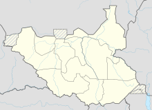 Maridi Location of Maridi Airport in South Sudan | |||||||||||
| Runways | |||||||||||
| |||||||||||
Sources:[1] | |||||||||||
Location
Maridi Airport (IATA: n/a, ICAO: HSMD) is located in Maridi East County in Maridi State, in the town of Maridi,[2] near the International border with the Democratic Republic of the Congo. This location lies approximately 236 kilometres (147 mi), by air, west of Juba International Airport, South Sudan's largest airport.[3] The geographic coordinates of this airport are: 4° 54' 0.00" N, 29° 26' 24.00"E (Latitude: 4.9000; Longitude: 29.4400). Maridi Airport is situated 700 metres (2,300 ft) above sea level.
Overview
Maridi Airport is a small civilian airport that serves the town of Maridi and surrounding communities. A flood in 1993 destroyed the easternmost portion of the runway. A packed dirt strip was hastily built; however, a permanent fix has not been created yet.
See also
References
- "HSMD - Maridi, EW, SS - Airport - Great Circle Mapper".
- "Citizens of Maridi join hands to clean Maridi Airport". Radio Tamazuj. 1 July 2016. Retrieved 20 August 2016.
- "Distance between Juba () (Airport) and Maridi (Al Wilayah al Istiwa'iyah) (Sudan)". distancecalculator.globefeed.com. Retrieved 2018-08-24.
External links
Другой контент может иметь иную лицензию. Перед использованием материалов сайта WikiSort.org внимательно изучите правила лицензирования конкретных элементов наполнения сайта.
WikiSort.org - проект по пересортировке и дополнению контента Википедии