avia.wikisort.org - Aerodrome
Marshall Islands International Airport (IATA: MAJ, ICAO: PKMJ, FAA LID: MAJ), also known as Amata Kabua International Airport, is located in the western part of Rairok on the south side of Majuro Atoll, the capital of the Republic of the Marshall Islands. The airport was built during World War II (1943) on Anenelibw and Lokojbar islets.[1] It replaced Majuro Airfield, a coral-surfaced airstrip at Delap Island near the eastern end of Majuro Atoll that had been originally constructed by Japanese occupation forces in 1942.[2][3]
Amata Kabua International Airport Marshall Islands International Airport | |||||||||||
|---|---|---|---|---|---|---|---|---|---|---|---|
 Welcome | |||||||||||
| |||||||||||
| Summary | |||||||||||
| Airport type | Public | ||||||||||
| Operator | RMI Ports Authority | ||||||||||
| Serves | Majuro | ||||||||||
| Location | Majuro | ||||||||||
| Elevation AMSL | 6 ft / 2 m | ||||||||||
| Coordinates | 07°03′53″N 171°16′19″E | ||||||||||
| Website | http://rmipa.com | ||||||||||
| Map | |||||||||||
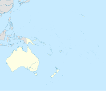
 Amata Kabua International Airport location of the Airport in Majuro, Marshall Islands  Amata Kabua International Airport Amata Kabua International Airport (Oceania) | |||||||||||
| Runways | |||||||||||
| |||||||||||
A series of single-floor structures (small hangars) make up the airport terminal. No physical structures existed at the airport prior to the 1970s. The current terminal structure and modern runway/apron were built in 1971.[4] Passengers from flights arriving at the airport use stairs to exit aircraft and walk to the terminal.
The airport is capable of handling all propeller-driven aircraft as well as midsize jet aircraft (e.g., Airbus A320s, Boeing 737s, Boeing 757s and Boeing 767s).
The Republic of the Marshall Islands Ports Authority replaced the Marshall Islands Airports Authority in managing the airport in 2003 under RMI Port Authority Act.[5][6]
Airport improvements
Sea walls have been added to prevent the sea from reclaiming the infill used to create the airport.[when?]
Between 2007 and 2009, airport improvement projects replaced the runway surfaces, rebuilt the apron to better handle aircraft, and repaved and added markings to the runway.[7] In 2007 the US FAA added two new airport crash tenders to the existing three-tender fleet, as part of the airport improvement projects.[7]
Airlines and destinations
This section does not cite any sources. (June 2014) |
| Airlines | Destinations |
|---|---|
| Air Marshall Islands | Ailuk, Airok, Aur, Bikini, Ebon, Elenak, Enejit, Enewetak, Jaluit, Jeh, Kaben, Kili, Kwajalein, Lae, Majkin, Maloelap, Mejit, Mili, Namdrik, Rongelap, Ujae, Utirik, Wotho, Wotje |
| Nauru Airlines | Brisbane, Nauru,[8] Pohnpei,[9] Tarawa[8] |
| United Airlines | Chuuk, Guam, Honolulu, Kosrae, Kwajalein, Pohnpei |
Ground transportation
Taxis and shuttle buses provide ground transportation to and from the airport to other areas of the island.[citation needed] The main and only road on Majuro Island provides access to the airport.
See also
- Island Hopper scheduled air service
References
- Sabath, Michael (1978). "Vegetation and Urbanization on Majuro Atoll, Marshall Islands" (PDF). Pacific Science. The University Press of Hawaii. 31 (4). ISSN 0030-8870. Retrieved 6 August 2018.
- "Around the world flight tribute recreation to Amelia Earhart page 4". 4 July 2008. Archived from the original on 4 July 2008.
- "Pacific Wrecks - Majuro Airport (New Airport)". Retrieved 27 July 2015.
- "CONSTRUCTING MAJURO AIRPORT RUNWAY AND TERMINAL.1971 - Reel 2859". Retrieved 27 July 2015.
- RMI Port Authority Act 2003 Archived 2011-06-05 at the Wayback Machine
- "About the Republic of the Marshall Islands Ports Authority". Republic of the Marshall Islands Ports Authority. Retrieved 27 July 2015.
- "Pacific International Inc". Archived from the original on 23 January 2016. Retrieved 27 July 2015.
- "NAURU AIRLINES RESUMES KIRIBATI / MARSHALL ISLANDS SERVICE IN MID-OCT 2022". AeroRoutes. 27 September 2022. Retrieved 27 September 2022.
- "NAURU AIRLINES RESUMES POHNPEI SERVICE FROM MID-OCT 2022". AeroRoutes. 2 October 2022. Retrieved 2 October 2022.
External links
- Majuro Atoll 737 Landing Video Fantastic video taken from the cockpit of a Boeing 737 on approach to, and landing at, the airport.
- Resources for this airport:
- FAA airport information for MAJ
- AirNav airport information for PKMJ
- ASN accident history for MAJ
- FlightAware airport information and live flight tracker
- NOAA/NWS latest weather observations for PKMJ
- SkyVector aeronautical chart for MAJ
На других языках
[de] Flughafen Marshallinseln
Der Flughafen Marshallinseln, offiziell Amata Kabua/Marshall Islands International Airport[1], ist der internationale Flughafen der Marshallinseln.- [en] Marshall Islands International Airport
[es] Aeropuerto Internacional Amata Kabua
El Aeropuerto Internacional Amata Kabua, es el único aeropuerto internacional de las Islas Marshall, situado en la capital, Dalap-Uliga-Darrit.[fr] Aéroport international des îles Marshall
L'aéroport international des îles Marshall est situé à Rairok, près Delap-Uliga-Darrit, la capitale du pays. Il est essentiellement utilisé par Air Marshall Islands, la compagnie aérienne nationale. Il porte le nom d'Amata Kabua, premier président des Îles Marshall et père de l'indépendance.[it] Aeroporto di Majuro
L'Aeroporto di Majuro (Amata Kabua International Airport) (IATA: MAJ, ICAO: PKMJ), è il principale aeroporto delle Isole Marshall. Realizzato sull'atollo Majuro, è collegato con gli altri scali della nazione.[ru] Международный аэропорт Маршалловых Островов
Международный аэропорт Маршалловых островов, также известный как Амата Кабуа Международный Аэропорт (англ. Marshall Islands International Airport), — международный аэропорт, который расположен на западе города Райрок в южной части аттола Маджуро, столицы республики Маршалловы Острова. Аэропорт построен во время Второй мировой войны в 1943 году. Он заменил аэродром Маджуро, имевший коралловое покрытие взлётно-посадочной полосы и построенный силами японскими оккупационных властей в 1942 году на востоке атолла.Другой контент может иметь иную лицензию. Перед использованием материалов сайта WikiSort.org внимательно изучите правила лицензирования конкретных элементов наполнения сайта.
WikiSort.org - проект по пересортировке и дополнению контента Википедии