avia.wikisort.org - Aerodrome
Nauru International Airport (IATA: INU, ICAO: ANYN) is the sole airport in the Republic of Nauru. The airport currently connects the country to one international passenger destination (Brisbane, Australia), served by Nauru's national airline, Nauru Airlines.
This article needs additional citations for verification. (April 2022) |
Nauru International Airport | |||||||||||
|---|---|---|---|---|---|---|---|---|---|---|---|
 Aerial view of the runway | |||||||||||
| |||||||||||
| Summary | |||||||||||
| Airport type | Public | ||||||||||
| Serves | Nauru | ||||||||||
| Location | Yaren District | ||||||||||
| Hub for | Nauru Airlines | ||||||||||
| Elevation AMSL | 7 m / 22 ft | ||||||||||
| Coordinates | 00°32′50.85″S 166°55′08.76″E | ||||||||||
| Website | nauruairlines | ||||||||||
| Map | |||||||||||
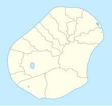 INU /ANYN Location in Yaren district, Nauru 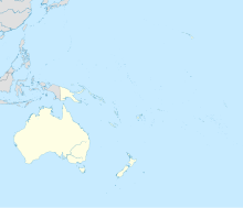 INU /ANYN INU /ANYN (Oceania) | |||||||||||
| Runways | |||||||||||
| |||||||||||
History
The airstrip was built during the World War II Japanese occupation of Nauru using forced labour. Operations began in January 1943. After the war, it was converted to a civilian airport.
The airport is located in the Yaren district, the least populated district in Nauru, just north of many of the government buildings, including the Parliament House, police station, and a secondary school. The airport holds the head office of flag carrier, Nauru Airlines.[1]
Also located at the airport are the Republic of Nauru Civil Aviation Authority, tasked with airport security and operational management; the Directorate of Immigration, tasked with control of incoming and outgoing passengers, and the Nauru Customs Service.
Airlines and destinations
Nauru International Airport serves as the main hub of the national carrier, Nauru Airlines.
| Airlines | Destinations |
|---|---|
| Nauru Airlines | Brisbane, Majuro,[2] Nadi,[2] Pohnpei,[3] Tarawa[2] |

References
- Contact Us Archived 2019-02-28 at the Wayback Machine. Retrieved on March 26, 2018. "Head Office Nauru International Airport PO Box 40 Republic of Nauru"
- "NAURU AIRLINES RESUMES KIRIBATI / MARSHALL ISLANDS SERVICE IN MID-OCT 2022". AeroRoutes. 27 September 2022. Retrieved 27 September 2022.
- "NAURU AIRLINES RESUMES POHNPEI SERVICE FROM MID-OCT 2022". AeroRoutes. 2 October 2022. Retrieved 2 October 2022.
External links
Nauru articles | |||||||
|---|---|---|---|---|---|---|---|
| History |
|  | |||||
| Geography |
| ||||||
| Politics |
| ||||||
| Economy |
| ||||||
| Society |
| ||||||
| |||||||
This Nauru-related article is a stub. You can help Wikipedia by expanding it. |
На других языках
[de] Flughafen Nauru
Der Internationale Flughafen der Republik Nauru (Republic of Nauru International Airport) ist der einzige Flughafen des Inselstaates Nauru. Er liegt im Südwesten der Insel in den Distrikten Yaren und Boe[1].- [en] Nauru International Airport
[es] Aeropuerto Internacional de Nauru
El Aeropuerto Internacional de Nauru es el único aeropuerto de la República de Nauru. Está localizado en el distrito de Yaren, junto a otros edificios gubernamentales, como la sede del Parlamento.[1][fr] Aéroport international de Nauru
L'aéroport international de Nauru (code IATA : INU • code OACI : ANYN)[1], en nauruan Reikoariata Republik Naoero, est l'unique aéroport de Nauru. Datant de la Seconde Guerre mondiale, c'est un élément important de son réseau de transport. Il est situé dans le sud-ouest de l'unique île de cet État et occupe une importante portion de sa plaine côtière. C'est un lien vital avec l'extérieur pour ce pays isolé au milieu de l'océan Pacifique ne disposant d'aucun port en eau profonde. En raison de son éloignement des grandes routes commerciales, il n'est desservi régulièrement que par la compagnie aérienne nationale du pays, Nauru Airlines, et la variation de son activité est donc fortement liée à la santé économique de cette entreprise.[it] Aeroporto Internazionale di Nauru
L'Aeroporto Internazionale di Nauru, in inglese Nauru International Airport, in nauruano Reikoariata Republik Naoero (IATA: INU, ICAO: ANYN) è l'unico aeroporto dell'omonima repubblica isolana.[ru] Науру (аэропорт)
Международный аэропорт Науру — единственный аэропорт в Науру. Является портом приписки компании Nauru Airlines. Осуществляются рейсы в Брисбен, Мельбурн, Хониару, Маджуро, Нади, Баирики. Расположен в округе Ярен.Другой контент может иметь иную лицензию. Перед использованием материалов сайта WikiSort.org внимательно изучите правила лицензирования конкретных элементов наполнения сайта.
WikiSort.org - проект по пересортировке и дополнению контента Википедии