avia.wikisort.org - Aerodrome
Namulonge Airport, also referred to as Namulonge Airstrip, is an airstrip serving the Namulonge Agronometeorology Station near the town of Namulonge in the Wakiso District of Uganda, 75 kilometres (47 mi) north of central Kampala.[2] The narrow runway is also used as a road and is surrounded by plowed fields of the agricultural research station.[1]
Namulonge Airport | |||||||||||
|---|---|---|---|---|---|---|---|---|---|---|---|
| |||||||||||
| Summary | |||||||||||
| Airport type | Civilian | ||||||||||
| Owner | Namulonge Agronometry Station | ||||||||||
| Serves | Namulonge, Uganda | ||||||||||
| Location | Namulonge, Uganda | ||||||||||
| Elevation AMSL | 3,871 ft / 1,180 m | ||||||||||
| Coordinates | 00°30′48″N 032°37′53″E | ||||||||||
| Map | |||||||||||
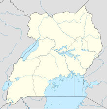
 Namulonge Location of the airport in Uganda | |||||||||||
| Runways | |||||||||||
| |||||||||||
Sources: Google Maps[1] | |||||||||||
The station has an automated airport weather station (AWOS) system installed.[3] The "HUNA" ICAO airport code may be no longer active.[4]
See also
- Transport in Uganda
- List of airports in Uganda
References
- Google Maps - Namulonge
- "Distance from Kampala Road to Namulonge Airport". Distances from. Retrieved 24 December 2021.
- WMO Namulonge AWOS evaluation
- "7 Results for 'HUNA'". www.world-airport-codes.com. Retrieved 2018-08-29.
External links
Текст в блоке "Читать" взят с сайта "Википедия" и доступен по лицензии Creative Commons Attribution-ShareAlike; в отдельных случаях могут действовать дополнительные условия.
Другой контент может иметь иную лицензию. Перед использованием материалов сайта WikiSort.org внимательно изучите правила лицензирования конкретных элементов наполнения сайта.
Другой контент может иметь иную лицензию. Перед использованием материалов сайта WikiSort.org внимательно изучите правила лицензирования конкретных элементов наполнения сайта.
2019-2025
WikiSort.org - проект по пересортировке и дополнению контента Википедии
WikiSort.org - проект по пересортировке и дополнению контента Википедии
