avia.wikisort.org - Aerodrome
Ogdensburg International Airport (IATA: OGS, ICAO: KOGS, FAA LID: OGS) is a public airport located in the town of Oswegatchie, 2 miles (3.2 km) southeast of Ogdensburg, in St. Lawrence County, New York.[1] It is owned by the Ogdensburg Bridge & Port Authority, which also owns and operates the Ogdensburg–Prescott International Bridge, Port of Ogdensburg-Marine Terminal Facility, Commerce Park, Port of Waddington, a medium-heavy industrial park and two short line railroads. The Ogdensburg Bridge and Port Authority is a New York State public-benefit corporation.[2][3] The international airport is just outside the city limits on NY 812. It is used for general aviation and commercial service. Scheduled commercial flights are operated by one airline: Contour Airlines (service is subsidized by the Essential Air Service program).
Ogdensburg International Airport | |||||||||||
|---|---|---|---|---|---|---|---|---|---|---|---|
| |||||||||||
| Summary | |||||||||||
| Airport type | Public | ||||||||||
| Owner | Ogdensburg Bridge & Port Authority | ||||||||||
| Serves | Ogdensburg, New York and Ottawa, Ontario | ||||||||||
| Location | Oswegatchie, New York | ||||||||||
| Elevation AMSL | 297 ft / 91 m | ||||||||||
| Coordinates | 44°40′55″N 075°27′56″W | ||||||||||
| Website | Ogdensburg International Airport | ||||||||||
| Map | |||||||||||
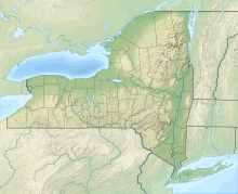 OGS Location of airport in New York  OGS OGS (the United States) | |||||||||||
| Runways | |||||||||||
| |||||||||||
| Statistics (2011) | |||||||||||
| |||||||||||
Source: Federal Aviation Administration[1] | |||||||||||
Federal Aviation Administration records say the airport had 603 passenger boardings (enplanements) in calendar year 2008,[4] 2,329 in 2010,[5] and 10,281 in 2016.[6] The National Plan of Integrated Airport Systems for 2011–2015 categorized it as a general aviation airport (the commercial service category requires at least 2,500 enplanements per year).[7]
Facilities
Ogdensburg International Airport covers 500 acres (202 ha) at an elevation of 297 feet (91 m). Its one runway, 9/27, was 5,200 by 150 feet (1,585 x 46 m) asphalt until the summer of 2016 when it was extended to 6,400 (1,951 m) by 150 feet (46 m) length. In the year ending March 23, 2015 the airport had 1,508 aircraft operations, average 126 per month: 71% air taxi, 21% general aviation, and 8% military. Seven aircraft were then based at the airport, all single-engine.[1] There are a handful of buildings: a small hangar, storage shed and fire hall.[8]
Airlines and destinations
Passenger
This section does not cite any sources. (January 2022) |
| Airlines | Destinations |
|---|---|
| Contour Airlines | Philadelphia[9] |
Airline flights (Mohawk DC-3s) started in 1957 after the airport got a 3,800 foot (1,200 m) paved runway.
A handful of tenants besides Skywest are at the airport:
- St. Lawrence Flying Club Incorporated – fixed wing and rotary flight training
Statistics
Annual traffic
| Passengers | Change from previous year | |
|---|---|---|
| 2010 | 4,450 | N/A |
| 2011 | 6,933 | |
| 2012 | 9,914 | |
| 2013 | 10,573 | |
| 2014 | 10,754 | |
| 2015 | 9,276 | |
| 2016 | 19,577 | |
| 2017 | 44,206 | |
| 2018 | 45,230 |
See also
Other New York State airports that target Canadian travellers:
- Plattsburgh International Airport – alternative to Montreal (Dorval)
- Buffalo International Airport – alternative to airports in the Toronto/Golden Horseshoe (Toronto Pearson, Hamilton John C. Munro, Toronto Billy Bishop)
- Watertown International Airport – alternative to Ottawa and Kingston
References
- FAA Airport Form 5010 for OGS PDF. Federal Aviation Administration. Effective October 15, 2015.
- "NYS OSC General Data Document describing the Ogdensburg Bridge and Port Authority" (PDF). November 4, 2018.
- "NYS Authorities Budget Office list of NYS Public Benefit Corporations". November 4, 2018.
- "Enplanements for CY 2008" (PDF, 1.0 MB). faa.gov. Federal Aviation Administration. December 18, 2009.
- "Enplanements for CY 2010" (PDF, 189 KB). faa.gov. Federal Aviation Administration. October 4, 2011.
- "Final CY 2016 Passenger Boardings, Rank Order, and Percent Change from 2015 Data" (PDF). faa.gov. Federal Aviation Administration. October 10, 2017.
- "2011–2015 NPIAS Report, Appendix A" (PDF). faa.gov. Federal Aviation Administration. October 4, 2010. Archived from the original (PDF, 2.03 MB) on September 27, 2012.
- "The Journal | Allegiant flights prepare for 2016 take off at Ogdensburg airport". www.ogd.com. Archived from the original on September 5, 2015.
- "Regulations.gov". www.regulations.gov. Retrieved May 16, 2022.
- "Ogdensburg, NY: Ogdensburg International (OGS)". Bureau of Transportation Statistics. Retrieved March 20, 2019.
Other sources
- Essential Air Service documents (Docket OST-1997-2842) from the U.S. Department of Transportation:
- Order 2005-5-8: reselects Mesa Air Group, Inc., d/b/a Air Midwest, to continue providing essential air service (EAS) at Massena, Ogdensburg and Watertown, New York, for a two-year period, and establishes an annual subsidy of $1,757,834 for service consisting of three round trips each weekday and three over the weekend period between the communities and Pittsburgh, with 19-seat Beech 1900D aircraft.
- Order 2006-12-22: selecting Big Sky Transportation Co., a wholly owned subsidiary of MAIR Holdings, Inc. d/b/a Big Sky Airlines, to provide essential air service (EAS) at Massena, Ogdensburg, and Watertown, New York, consisting of 18 weekly round trips, three each weekday and three each weekend, to Boston, with 19-seat Beech 1900D turboprop aircraft for the two-year period beginning on or about March 1, 2007, at a combined annual subsidy of $2,097,906.
- Order 2008-3-15: selecting Hyannis Air Service, Inc. d/b/a Cape Air, to provide subsidized essential air service (EAS) at Massena, Ogdensburg, and Watertown, New York, for the two-year period beginning when the carrier inaugurates full EAS pursuant to this Order, at a total annual subsidy of $3,879,863.
- Order 2011-1-6: selecting Hyannis Air Service, Inc. d/b/a Cape Air (Cape Air), to continue providing subsidized essential air service (EAS) at Massena (for two years), at the annual subsidy rate of $1,708,911, and at Ogdensburg (for four years), at the annual subsidy rate of $1,702,697, beginning when the carrier inaugurates the new service pattern.
External links
- Airport information at Ogdensburg Bridge and Port Authority website
- "Airport diagram" (PDF). at New York State DOT website
- FAA Terminal Procedures for OGS, effective July 14, 2022
- Resources for this airport:
- FAA airport information for OGS
- AirNav airport information for KOGS
- ASN accident history for OGS
- FlightAware airport information and live flight tracker
- NOAA/NWS weather observations: current, past three days
- SkyVector aeronautical chart, Terminal Procedures
Officers in the State of New York | ||
|---|---|---|
| Current offices |
|  |
| Defunct offices |
| |
Другой контент может иметь иную лицензию. Перед использованием материалов сайта WikiSort.org внимательно изучите правила лицензирования конкретных элементов наполнения сайта.
WikiSort.org - проект по пересортировке и дополнению контента Википедии