avia.wikisort.org - Aerodrome
Saül Airport (IATA: XAU, ICAO: SOOS) is an airstrip serving Saül, a commune of French Guiana.
Saül Airport | |||||||||||
|---|---|---|---|---|---|---|---|---|---|---|---|
 Saül Airport's terminal building | |||||||||||
| |||||||||||
| Summary | |||||||||||
| Operator | Conseil Général de la Guyane | ||||||||||
| Serves | Saül, French Guiana | ||||||||||
| Elevation AMSL | 703 ft / 214 m | ||||||||||
| Coordinates | 03°36′55″N 53°12′15″W | ||||||||||
| Map | |||||||||||
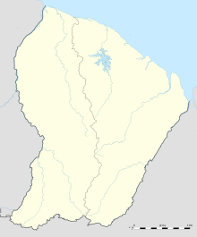 XAU Location of airport in French Guiana | |||||||||||
| Runways | |||||||||||
| |||||||||||
The airport is just southeast of the village. There are low hills west and northeast of the runway. The Saul non-directional beacon (Ident: SU) is located in the village.[3]
Airlines and destinations
| Airlines | Destinations |
|---|---|
| Air Guyane Express | Cayenne, Maripasoula[4] |
Statistics
Annual passenger traffic at XAU airport.
See source Wikidata query.
See also
- List of airports in French Guiana
- Transport in French Guiana
References
- Airport information for Saül Airport at Great Circle Mapper.
- Google Maps - Saül Airport
- Saul NDB
- "Air Guyane Express". Retrieved 23 August 2010.
External links
- OpenStreetMap - Saül
- OurAirports - Saül Airport
- SkyVector - Saül Airport
- Accident history for Saül Airport at Aviation Safety Network
This article about an airport in French Guiana is a stub. You can help Wikipedia by expanding it. |
На других языках
- [en] Saül Airport
[fr] Aérodrome de Saül
@media all and (max-width:720px){body.skin-minerva .mw-parser-output *[class*="infobox"] table{display:table}body.skin-minerva .mw-parser-output *[class*="infobox"] caption{display:table-caption}}Текст в блоке "Читать" взят с сайта "Википедия" и доступен по лицензии Creative Commons Attribution-ShareAlike; в отдельных случаях могут действовать дополнительные условия.
Другой контент может иметь иную лицензию. Перед использованием материалов сайта WikiSort.org внимательно изучите правила лицензирования конкретных элементов наполнения сайта.
Другой контент может иметь иную лицензию. Перед использованием материалов сайта WikiSort.org внимательно изучите правила лицензирования конкретных элементов наполнения сайта.
2019-2025
WikiSort.org - проект по пересортировке и дополнению контента Википедии
WikiSort.org - проект по пересортировке и дополнению контента Википедии