avia.wikisort.org - Aerodrome
Tau Airport (IATA: TAV, FAA LID: HI36) was a privately owned, private-use airport located 1.6 kilometers (0.99 mi) southeast of the village of Ta‘ū on the island of Ta‘ū in American Samoa, an unincorporated territory of the United States.[1] The airport was located in the northwest corner of Ta‘ū island. Tau Airport was deactivated in 1990, and was replaced by Fitiuta Airport, located on the northeast side of the island. Satellite imagery from 2015 does not appear to show any remnants of the airport.
Tau Airport | |||||||||||
|---|---|---|---|---|---|---|---|---|---|---|---|
| |||||||||||
| Summary | |||||||||||
| Airport type | Private | ||||||||||
| Owner | Private Individuals | ||||||||||
| Location | Tau, American Samoa, United States | ||||||||||
| Elevation AMSL | 56 m / 185 ft | ||||||||||
| Coordinates | 14°13′45″S 169°30′40″W | ||||||||||
| Map | |||||||||||
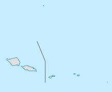 TAV | |||||||||||
| Runways | |||||||||||
| |||||||||||
| Statistics (1989) | |||||||||||
| |||||||||||
Source: Federal Aviation Administration[1] | |||||||||||
Facilities and aircraft
Tau Airport previously covered an area of 1.6 hectares (4 acres) and had one runway (18/36) measuring 661 m × 30 m (2,170 ft × 100 ft). The runway surface was compacted coral in the center 15 meters (50 ft), with the rest of runway composed of dirt and grass.[1]
According to the last issued FAA data, for 12-month period ending March 8, 1989, the airport had 4,380 aircraft operations, an average of 12 per day: 67% general aviation and 33% air taxi.[1]
References
- FAA Airport Form 5010 for HI36 PDF, retrieved 2007-03-15
External links
- National Park Service map of the Manu‘a Islands showing location of Ta‘ū village on the island of Ta‘ū.
- Resources for this airport:
- Airport information for HI36 at AirNav
- Accident history for TAV at Aviation Safety Network
This article about an Oceanian airport is a stub. You can help Wikipedia by expanding it. |
This American Samoa location article is a stub. You can help Wikipedia by expanding it. |
На других языках
- [en] Tau Airport
[it] Aeroporto di Taʻu
L'aeroporto di Taʻu è un aeroporto privato situato 2 chilometri a sud est del villaggio di Luma, sull'isola di Taʻu, nella contea di Taʻu delle Samoa Americane. Precedentemente di proprietà dello Stato oceaniano fu chiuso nel 1989.[1] ed è ora di proprietà di privati e non più attivo in seguito allo sviluppo dell'aeroporto di Fitiuta nella parte nord-orientale dell'isola.[ru] Тау (аэропорт)
Аэропорт Тау (англ. Tau Airport; ИАТА: TAV, FAA LID: HI36) — бывший частный аэропорт, расположенный в 1,6 км к юго-востоку от посёлка Тау, в северо-восточной части одноимённого острова в составе Американского Самоа, невключённой неорганизованной территории США.Другой контент может иметь иную лицензию. Перед использованием материалов сайта WikiSort.org внимательно изучите правила лицензирования конкретных элементов наполнения сайта.
WikiSort.org - проект по пересортировке и дополнению контента Википедии