avia.wikisort.org - Aerodrome
Vahitahi Airport (IATA: VHZ, ICAO: NTUV) is an airport that serves the village of Mohitu, located on the Vahitahi atoll, in the Tuamotu group of atolls in French Polynesia, 960 kilometres (600 mi) from Tahiti. Vahitahi atoll Airport was inaugurated in 1978.
Vahitahi Airport Aérodrome de Vahitahi | |||||||||||
|---|---|---|---|---|---|---|---|---|---|---|---|
 NASA satellite image of Vahitahi | |||||||||||
| |||||||||||
| Summary | |||||||||||
| Airport type | Public | ||||||||||
| Operator | DSEAC Polynésie Française | ||||||||||
| Serves | Vahitahi, Tuamotu, French Polynesia | ||||||||||
| Elevation AMSL | 3 m / 10 ft | ||||||||||
| Coordinates | 18°46′48″S 138°51′11″W | ||||||||||
| Map | |||||||||||
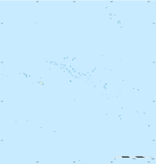 VHZ Location of the airport in French Polynesia | |||||||||||
| Runways | |||||||||||
| |||||||||||
Statistics
Annual passenger traffic at VHZ airport.
See Wikidata query.
References
- NTUV – Vahitahi. AIP from French Service d'information aéronautique, effective 8 September 2022.
- Airport information for NTUV at Great Circle Mapper.
- Airport information for Vahitahi Airport at Transport Search website.
External links
Tuamotu Archipelago and Gambier Islands of French Polynesia | |||
|---|---|---|---|
Tuamotus Gambiers | Islands/Atolls | ||
| Island groups | |||
This article about an Oceanian airport is a stub. You can help Wikipedia by expanding it. |
This French Polynesia-related geography article is a stub. You can help Wikipedia by expanding it. |
На других языках
[de] Flughafen Vahitahi
Der Flughafen Vahitahi ist ein regionaler Flughafen auf dem Vahitahi-Atoll in Französisch-Polynesien. Er liegt südlich des Ortes Mohitu und befindet sich rund 1150 Kilometer östlich der Hauptinsel Tahiti.- [en] Vahitahi Airport
[fr] Aérodrome de Vahitahi
@media all and (max-width:720px){body.skin-minerva .mw-parser-output *[class*="infobox"] table{display:table}body.skin-minerva .mw-parser-output *[class*="infobox"] caption{display:table-caption}}Текст в блоке "Читать" взят с сайта "Википедия" и доступен по лицензии Creative Commons Attribution-ShareAlike; в отдельных случаях могут действовать дополнительные условия.
Другой контент может иметь иную лицензию. Перед использованием материалов сайта WikiSort.org внимательно изучите правила лицензирования конкретных элементов наполнения сайта.
Другой контент может иметь иную лицензию. Перед использованием материалов сайта WikiSort.org внимательно изучите правила лицензирования конкретных элементов наполнения сайта.
2019-2026
WikiSort.org - проект по пересортировке и дополнению контента Википедии
WikiSort.org - проект по пересортировке и дополнению контента Википедии