avia.wikisort.org - Aérodrome
| Aérodrome de Vahitahi | ||||||||||

| ||||||||||
| Localisation | ||||||||||
|---|---|---|---|---|---|---|---|---|---|---|
| Pays | ||||||||||
| Collectivité | ||||||||||
| Ville | Vahitahi | |||||||||
| Date d'ouverture | 1978 | |||||||||
| Coordonnées | 18° 46′ 48″ sud, 138° 51′ 11″ ouest | |||||||||
| Altitude | 3 m (10 ft) | |||||||||
| Informations aéronautiques | ||||||||||
| Code IATA | VHZ | |||||||||
| Code OACI | NTUV | |||||||||
| Type d'aéroport | civil | |||||||||
|
||||||||||
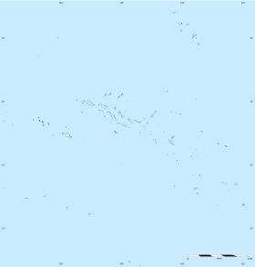
| Géolocalisation sur la carte : Polynésie française
| ||||||||||
| modifier |
||||||||||
Cet article est une ébauche concernant la Polynésie française et un aéroport.
Vous pouvez partager vos connaissances en l’améliorant (comment ?) selon les recommandations des projets correspondants.
L'aérodrome de Vahitahi (code IATA : VHZ • code OACI : NTUV) est un aérodrome desservant l'atoll de Vahitahi dans l'archipel des Tuamotu en Polynésie française.
Situation
Nengo-Nengo |

Compagnies et destinations
 Air Tahiti (Tahiti)
Statistiques
Voir la requête brute et les sources sur Wikidata. [1]
Notes et références
- « Union des Aéroports Français », sur aeroport.fr (consulté le ).
 Portail de l’aéronautique
  Portail de la Polynésie française
На других языках
[de] Flughafen Vahitahi
Der Flughafen Vahitahi ist ein regionaler Flughafen auf dem Vahitahi-Atoll in Französisch-Polynesien. Er liegt südlich des Ortes Mohitu und befindet sich rund 1150 Kilometer östlich der Hauptinsel Tahiti.[en] Vahitahi Airport
Vahitahi Airport (IATA: VHZ, ICAO: NTUV) is an airport that serves the village of Mohitu, located on the Vahitahi atoll, in the Tuamotu group of atolls in French Polynesia, 960 kilometres (600 mi) from Tahiti. Vahitahi atoll Airport was inaugurated in 1978.- [fr] Aérodrome de Vahitahi
Текст в блоке "Читать" взят с сайта "Википедия" и доступен по лицензии Creative Commons Attribution-ShareAlike; в отдельных случаях могут действовать дополнительные условия.
Другой контент может иметь иную лицензию. Перед использованием материалов сайта WikiSort.org внимательно изучите правила лицензирования конкретных элементов наполнения сайта.
Другой контент может иметь иную лицензию. Перед использованием материалов сайта WikiSort.org внимательно изучите правила лицензирования конкретных элементов наполнения сайта.
2019-2025
WikiSort.org - проект по пересортировке и дополнению контента Википедии
WikiSort.org - проект по пересортировке и дополнению контента Википедии